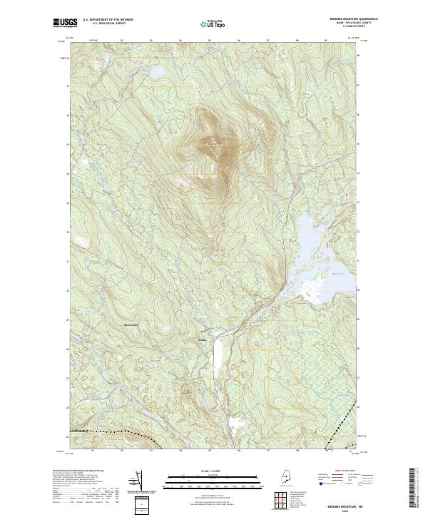
2024 Map of Ebeemee Mountain
USGS Topo · Published 2024About this map
The Middle Branch Pleasant River and its various tributaries define the drainage of this Piscataquis County landscape, where the settlements of Mooresville, Prairie, and Williamsburg represent the local human footprint. The terrain is dominated by the prominence of Ebeemee Mtn and Bull Hill, with the distinctively labeled Horseback ridge running alongside the river valley.
Find a feature on this map
31 named features on this map. Tap any name to fly to it.
Don’t see what you’re looking for? This feature index may not catch every label — zoom into the map to look around manually.
Map Details
Editions of this 2024 Ebeemee Mountain Map
This is the sole edition of this map. No revisions or reprints were ever made.
Other maps of this area

1940 · Sebec
USGS Topo · 1:48,000

1943 · Sebec
USGS Topo · 1:62,500

1947 · Schoodic
USGS Topo · 1:62,500

1949 · Schoodic
USGS Topo · 1:62,500

1951 · Norcross
USGS Topo · 1:62,500

1952 · Jo-Mary Mountain
USGS Topo · 1:62,500

1954 · Millinocket
USGS Topo · 1:250,000

1958 · Millinocket
USGS Topo · 1:250,000

1960 · Millinocket
USGS Topo · 1:250,000
1978 · Silver Lake
USGS Topo · 1:24,000
Featured Places
- Brownville, ME
- Katahdin Iron Works Township, ME
- TB R11 WELS, ME
- Williamsburg Township, ME
- Ebeemee Township, ME