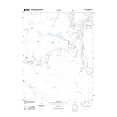
2012 Map of Echo Lake
USGS Topo · Published 2012About this map
Meyers serves as the primary gateway to the high Sierra landscape of this 2012 survey, where the Upper Truckee River flows through a developed network of residential streets and golf courses. The map records a transition from the structured community around Tahoe Paradise Junior College to the higher alpine reaches of the Sierra Nevada. Transportation history is etched into the terrain along Johnson Pass and the steep grade leading to Echo Summit, reflecting the vital transit corridors that have long connected this region.
Find a feature on this map
119 named features on this map. Tap any name to fly to it.
Don’t see what you’re looking for? This feature index may not catch every label — zoom into the map to look around manually.
Map Details
Editions of this 2012 Echo Lake Map
This is the sole edition of this map. No revisions or reprints were ever made.
Other maps of this area

1889 · Pyramid Peak
USGS Topo · 1:125,000

1889 · Markleeville
USGS Topo · 1:125,000

1891 · Markleeville
USGS Topo · 1:125,000

1891 · Pyramid Peak
USGS Topo · 1:125,000

1893 · Markleeville
USGS Topo · 1:125,000

1895 · Pyramid Peak
USGS Topo · 1:125,000

1896 · Pyramid Peak
USGS Topo · 1:125,000

1947 · Sacramento
USGS Topo · 1:250,000

1948 · Walker Lake
USGS Topo · 1:250,000

1948 · Sacramento
USGS Topo · 1:250,000