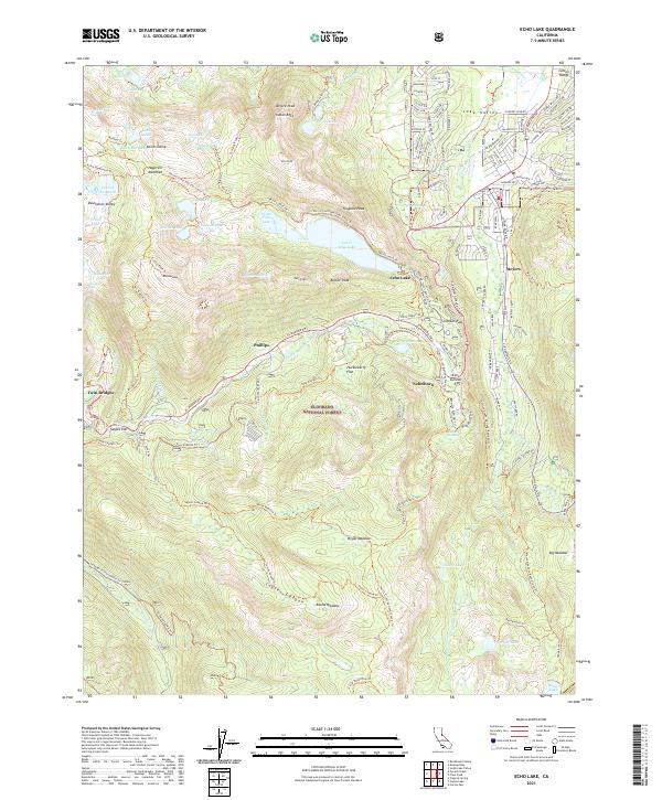
2021 Map of Echo Lake
USGS Topo · Published 2021About this map
The Carson Range and the high alpine terrain of the Eldorado National Forest dominate this landscape, where the Upper Truckee River and S Fork American River originate from a network of glacial basins. The map illustrates a concentration of modern development in Lake Valley and around Meyers, contrasting with the protected wilderness of Desolation Valley. This transition is most evident near Echo Summit, where the El Dorado Fwy climbs toward Johnson Pass, a route steeped in the history of the Lincoln Highway and the Pony Express. High-elevation landmarks like Angora Peak, Keiths Dome, and Talking Mtn overlook numerous small water bodies, including Lake of the Woods and the interconnected Upper Echo Lake and Lower Echo Lake. These features reflect a landscape shaped by both intense recreational use and its role as a critical watershed for the surrounding Sierra Nevada region.
Find a feature on this map
134 named features on this map. Tap any name to fly to it.
Don’t see what you’re looking for? This feature index may not catch every label — zoom into the map to look around manually.
Map Details
Editions of this 2021 Echo Lake Map
This is the sole edition of this map. No revisions or reprints were ever made.
Other maps of this area

1889 · Pyramid Peak
USGS Topo · 1:125,000

1889 · Markleeville
USGS Topo · 1:125,000

1891 · Markleeville
USGS Topo · 1:125,000

1891 · Pyramid Peak
USGS Topo · 1:125,000

1893 · Markleeville
USGS Topo · 1:125,000

1895 · Pyramid Peak
USGS Topo · 1:125,000

1896 · Pyramid Peak
USGS Topo · 1:125,000

1947 · Sacramento
USGS Topo · 1:250,000

1948 · Walker Lake
USGS Topo · 1:250,000

1948 · Sacramento
USGS Topo · 1:250,000