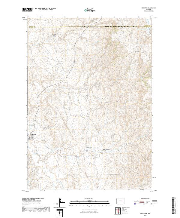
2021 Map of Edgerton
USGS Topo · Published 2021About this map
Edgerton stands as the primary settlement on this landscape, where the southern reaches of Johnson County meet northern Natrona County. The terrain is defined by an intricate network of ephemeral drainages and intermittent streams, including the descriptive Dead Dog Draw and Joe Begant Draw, which carve through the high plains. Water management in this arid environment is evidenced by the Meadow Cr Reservoir in the northeast corner, capturing flow from Meadow Cr. The infrastructure of the area is centered around the small grid of Edgerton, specifically along Center St and the winding Co Rd 117 which follows the path of Salt Cr. This topography, characterized by features like North Sherwood Draw and King Draw, reflects the historic ranching and resource extraction patterns common to this part of the Wyoming prairie.
Find a feature on this map
23 named features on this map. Tap any name to fly to it.
Don’t see what you’re looking for? This feature index may not catch every label — zoom into the map to look around manually.
Map Details
Editions of this 2021 Edgerton Map
This is the sole edition of this map. No revisions or reprints were ever made.
Other maps of this area

1954 · Linch
USGS Topo · 1:24,000

1954 · Taylor Ranch
USGS Topo · 1:24,000

1955 · Arminto
USGS Topo · 1:250,000

1958 · Arminto
USGS Topo · 1:250,000

1959 · Edgerton
USGS Topo · 1:62,500

1961 · Dead Woman Crossing
USGS Topo · 1:24,000

1962 · Arminto
USGS Topo · 1:250,000

1968 · Midwest
USGS Topo · 1:24,000

1968 · Salt Creek
USGS Topo · 1:24,000
1981 · Midwest
USGS Topo · 1:100,000