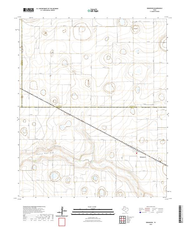
2022 Map of Edmonson
USGS Topo · Published 2022About this map
Edmonson sits as the primary settlement on this portion of the Texas High Plains, positioned where the grid of rural roads meets the diagonal line of the railway and highway. The landscape is defined by the significant winding path of Running Water Draw, also labeled as Running River Draw, which carves a distinct natural course across the otherwise orderly agricultural layout. This terrain is marked by numerous small depressions and playas typical of the region, interspersed between local connectors like FM 145 and FM 179. The map documents a convergence of political boundaries, showing the point where Swisher County and Hale County meet, as well as the border with Castro County. These survey lines and the drainage pattern of the draws illustrate how geography and county divisions shaped the development of this farming community.
Find a feature on this map
34 named features on this map. Tap any name to fly to it.
Don’t see what you’re looking for? This feature index may not catch every label — zoom into the map to look around manually.
Map Details
Editions of this 2022 Edmonson Map
This is the sole edition of this map. No revisions or reprints were ever made.
Other maps of this area

1954 · Plainview
USGS Topo · 1:250,000

1954 · Clovis
USGS Topo · 1:250,000

1958 · Clovis
USGS Topo · 1:250,000

1958 · Plainview
USGS Topo · 1:250,000

1965 · Hart
USGS Topo · 1:24,000

1965 · Edmonson NE
USGS Topo · 1:24,000

1965 · Kress West
USGS Topo · 1:24,000

1965 · Edmonson
USGS Topo · 1:24,000

1965 · Hilburn
USGS Topo · 1:24,000

1965 · Center Plains School
USGS Topo · 1:24,000