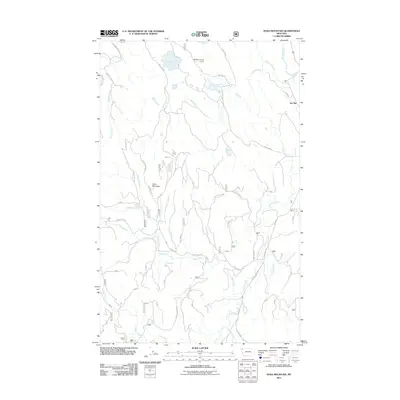
2011 Map of Edna Mountain
USGS Topo · Published 2011About this map
Edna Mountain and the surrounding Lincoln County highlands are documented in this 2011 survey, revealing a landscape defined by an extensive network of forest roads and alpine water bodies. The terrain is dominated by various drainages including Edna Creek, Fortine Creek, and Meadow Creek, which carve through the high country. Near the northern boundary, the Roberts Lookout Tower stands as a prominent landmark overlooking Marl Lake, Loon Lake, and Deep Lake.
Find a feature on this map
77 named features on this map. Tap any name to fly to it.
Don’t see what you’re looking for? This feature index may not catch every label — zoom into the map to look around manually.
Map Details
Editions of this 2011 Edna Mountain Map
This is the sole edition of this map. No revisions or reprints were ever made.
Other maps of this area

1913 · Stryker
USGS Topo · 1:125,000

1916 · Stryker
USGS Topo · 1:125,000

1957 · Kalispell
USGS Topo · 1:250,000

1960 · Kalispell
USGS Topo · 1:250,000

1961 · Kalispell
USGS Topo · 1:250,000

1963 · Mount Marston
USGS Topo · 1:24,000

1963 · Eureka South
USGS Topo · 1:24,000

1963 · Davis Mountain
USGS Topo · 1:24,000

1963 · Stryker
USGS Topo · 1:24,000
1963 · Skillet Mountain
USGS Topo · 1:24,000