
1963 Map of Mount Marston
USGS Topo · Published 1966About this map
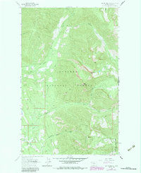
The high ridges of Lincoln County, Montana, are documented here in the early 1960s, showing a landscape defined by the drainage systems of Cat Creek, Grove Creek, and Williams Creek. This high-altitude terrain, largely within the Kootenai National Forest and the Stillwater State Forest, is characterized by prominent landmarks like Mt Marston and Krinklehorn Peak. The map reveals the era's mining and access history, with the Schwab Mine and Jager Mine tucked into the mountain slopes.
Find a feature on this map
19 named features on this map. Tap any name to fly to it.
Don’t see what you’re looking for? This feature index may not catch every label — zoom into the map to look around manually.
Map Details
Editions of this 1963 Mount Marston Map
2 editions found
Other maps of this area

1913 · Stryker
USGS Topo · 1:125,000

1916 · Stryker
USGS Topo · 1:125,000

1957 · Kalispell
USGS Topo · 1:250,000

1960 · Kalispell
USGS Topo · 1:250,000

1961 · Kalispell
USGS Topo · 1:250,000

1963 · Ksanka Peak
USGS Topo · 1:24,000

1963 · Stryker
USGS Topo · 1:24,000

1963 · Stahl Peak
USGS Topo · 1:24,000
1963 · Edna Mountain
USGS Topo · 1:24,000
1963 · Fortine
USGS Topo · 1:24,000