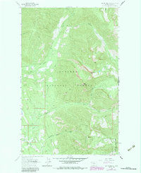
1963 Map of Mount Marston
USGS Topo · Published 1984About this map
Kootenai National Forest and the neighboring Stillwater State Forest dominate this high-altitude landscape of northwest Montana as it was recorded in the early 1960s. The topography is defined by the massive Gibralter Ridge and Patrick Ridge, which separate a series of steep drainages including Grave Creek, Williams Creek, and the evocatively named Laughing Water Creek. Peaks like Krinklenhorn Peak and Mt Marston serve as primary landmarks for navigation through this wilderness, while a complex network of labeled Pack Trails indicates how the land was managed and traversed by the U.S. Forest Service before modern road development was fully realized. Human activity is sparse but specific, with a lone Mine and a Gaging Sta located along the watercourses, suggesting a focus on resource extraction and hydrological monitoring in this remote corner of Lincoln County.
Find a feature on this map
17 named features on this map. Tap any name to fly to it.
Don’t see what you’re looking for? This feature index may not catch every label — zoom into the map to look around manually.
Map Details
Editions of this 1963 Mount Marston Map
2 editions found
Other maps of this area

1913 · Stryker
USGS Topo · 1:125,000

1916 · Stryker
USGS Topo · 1:125,000

1957 · Kalispell
USGS Topo · 1:250,000

1960 · Kalispell
USGS Topo · 1:250,000

1961 · Kalispell
USGS Topo · 1:250,000

1963 · Mount Marston
USGS Topo · 1:24,000

1963 · Ksanka Peak
USGS Topo · 1:24,000

1963 · Stryker
USGS Topo · 1:24,000

1963 · Stahl Peak
USGS Topo · 1:24,000
1963 · Edna Mountain
USGS Topo · 1:24,000