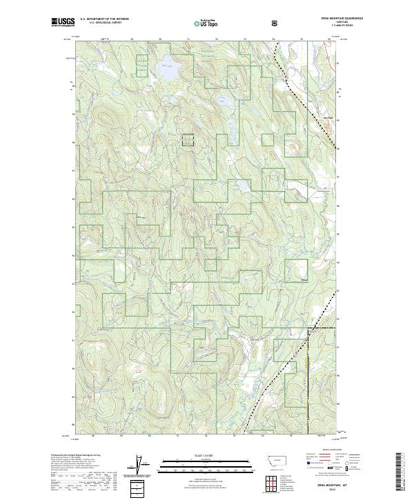
2024 Map of Edna Mountain
USGS Topo · Published 2024About this map
Edna Mtn rises above a landscape defined by the dense drainages and glacial lakes of the Kootenai National Forest near the Lincoln and Flathead county line. This contemporary survey captures the extensive network of forest development roads that thread through the timberland, including Natl Forest Develop Road 1042 RD and Edna Creek RD. The small settlement of Trego sits near the eastern edge of the quadrangle, while Ant Flat marks a historic node to the north. Water is a dominant feature of this terrain, from the clear waters of Marl Lake and Deep Lake to the meandering course of Fortine Creek and the marshy reaches of Dudley Slough. The intricate contouring reflects a territory shaped by steep ridges and creek valleys, where traditional land use and recreation converge on routes like the Ant Flat Trl.
Find a feature on this map
50 named features on this map. Tap any name to fly to it.
Don’t see what you’re looking for? This feature index may not catch every label — zoom into the map to look around manually.
Map Details
Editions of this 2024 Edna Mountain Map
This is the sole edition of this map. No revisions or reprints were ever made.
Other maps of this area

1913 · Stryker
USGS Topo · 1:125,000

1916 · Stryker
USGS Topo · 1:125,000

1957 · Kalispell
USGS Topo · 1:250,000

1960 · Kalispell
USGS Topo · 1:250,000

1961 · Kalispell
USGS Topo · 1:250,000

1963 · Mount Marston
USGS Topo · 1:24,000

1963 · Eureka South
USGS Topo · 1:24,000

1963 · Davis Mountain
USGS Topo · 1:24,000

1963 · Stryker
USGS Topo · 1:24,000
1963 · Skillet Mountain
USGS Topo · 1:24,000