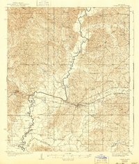
1938 Map of Edwards
USGS Topo · Published 1943About this map
The Big Black River snakes along the boundary between Warren and Hinds counties, creating a landscape of oxbow lakes and wetlands such as Gin Lake, July Lake, and Tomcat Island. In the mid-1930s, this area was defined by a dense network of rural infrastructure, notably featuring Mt Beulah College and an extensive array of community hubs like Little Kingdom Come Ch and China Grove Ch. The settlement of Edwards serves as a central point, with the surrounding hillsides dotted by specialized sites including Champion Hill and numerous schools like Holy Hill Sch and Oak Ridge Sch.
Find a feature on this map
83 named features on this map. Tap any name to fly to it.
Don’t see what you’re looking for? This feature index may not catch every label — zoom into the map to look around manually.
Map Details
Editions of this 1938 Edwards Map
3 editions found
Other maps of this area

1903 · Jackson
USGS Topo · 1:125,000

1918 · Vicksburg
USGS Topo · 1:62,500

1934 · Raymond
USGS Topo · 1:48,000

1937 · Raymond
USGS Topo · 1:62,500

1937 · Terry
USGS Topo · 1:48,000

1938 · Edwards
USGS Topo · 1:62,500

1939 · Onward
USGS Topo · 1:62,500

1939 · Yokena
USGS Topo · 1:62,500

1940 · Mechanicsburg
USGS Topo · 1:62,500

1941 · Vicksburg
USGS Topo · 1:62,500