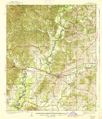
1938 Map of Edwards
USGS Topo · Published 1938About this map
Big Black River forms a winding natural boundary between Warren and Hinds counties, defining a landscape of oxbow lakes and dense creek networks. The rail-oriented economy of the mid-1930s is anchored by Edwards and the tracks of the Yazoo and Mississippi Valley railroad, which crosses the river near Smiths. This area is characterized by a high density of rural community centers, particularly a significant number of country schools and churches that served as the social backbone for farming families. Of particular note is Mt Beulah College, situated just west of Edwards. The topography reveals the complex drainage of Fourteenmile Creek and Bakers Creek, while family-named landmarks like Askew Pond and Armstrong Pond offer specific points of interest for genealogists tracing local landholdings in this part of Mississippi.
Find a feature on this map
81 named features on this map. Tap any name to fly to it.
Don’t see what you’re looking for? This feature index may not catch every label — zoom into the map to look around manually.
Map Details
Editions of this 1938 Edwards Map
3 editions found
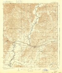
Other maps of this area

1903 · Jackson
USGS Topo · 1:125,000

1918 · Vicksburg
USGS Topo · 1:62,500

1934 · Raymond
USGS Topo · 1:48,000

1937 · Raymond
USGS Topo · 1:62,500

1937 · Terry
USGS Topo · 1:48,000

1938 · Edwards
USGS Topo · 1:62,500

1939 · Onward
USGS Topo · 1:62,500

1939 · Yokena
USGS Topo · 1:62,500

1940 · Mechanicsburg
USGS Topo · 1:62,500

1941 · Vicksburg
USGS Topo · 1:62,500