
1937 Map of Terry
USGS Topo · Published 1937About this map
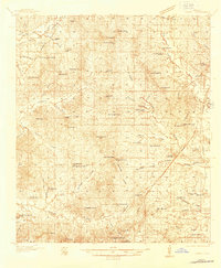
The town of Terry serves as the focal point for this Hinds County landscape, situated along the Illinois Central Railroad and State Highway No 51. The map reveals a dense network of early 20th-century rural infrastructure, particularly evident in the high concentration of neighborhood schools such as the Hester Rosenwald Sch, Taylor Grove Sch, and Mt Wade Sch. These institutions, alongside numerous churches like Mt Beulah Ch and Spring Ridge Ch, highlight the organized social structure of the local farming communities during the mid-1930s. To the south, Old Crystal Springs and Chautauqua indicate the historical migration of settlement centers, while the western reaches are defined by the winding course of Fourteenmile Creek and Tallahalla Creek. The presence of Coopers Wells and a Recreation Camp suggest the area's role as a destination for health and leisure in this era.
Find a feature on this map
84 named features on this map. Tap any name to fly to it.
Don’t see what you’re looking for? This feature index may not catch every label — zoom into the map to look around manually.
Map Details
Editions of this 1937 Terry Map
3 editions found
Other maps of this area

1903 · Jackson
USGS Topo · 1:125,000

1905 · Jackson
USGS Topo · 1:48,000

1906 · Florence
USGS Topo · 1:62,500

1908 · Jackson
USGS Topo · 1:62,500

1908 · Florence
USGS Topo · 1:62,500

1934 · Raymond
USGS Topo · 1:48,000

1937 · Raymond
USGS Topo · 1:62,500

1938 · Edwards
USGS Topo · 1:62,500

1942 · Raymond
USGS Topo · 1:62,500

1943 · Terry
USGS Topo · 1:62,500