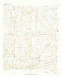
1937 Map of Terry
USGS Topo · Published 1965About this map
The Illinois Central railroad corridor serves as the primary artery for southern Hinds County in the late 1930s, anchoring the town of Terry and smaller rail stops like Vaughn and Moncure. This interior landscape is defined by its deep network of rural institutions, including dozens of country schools such as Seven Springs Sch and Elda Hill Sch, alongside landmarks like Morgans Store and Dabney Crossroads.
Find a feature on this map
92 named features on this map. Tap any name to fly to it.
Don’t see what you’re looking for? This feature index may not catch every label — zoom into the map to look around manually.
Map Details
Editions of this 1937 Terry Map
3 editions found
Other maps of this area

1903 · Jackson
USGS Topo · 1:125,000

1905 · Jackson
USGS Topo · 1:48,000

1906 · Florence
USGS Topo · 1:62,500

1908 · Jackson
USGS Topo · 1:62,500

1908 · Florence
USGS Topo · 1:62,500

1934 · Raymond
USGS Topo · 1:48,000

1937 · Raymond
USGS Topo · 1:62,500

1937 · Terry
USGS Topo · 1:48,000

1938 · Edwards
USGS Topo · 1:62,500

1942 · Raymond
USGS Topo · 1:62,500