
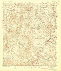
1943 Map of Terry
USGS Topo · Published 1943About this map
Terry serves as the central hub of this 1930s landscape, situated along the Illinois Central railroad corridor in southern Hinds County. The area is defined by a dense network of country schools and rural churches that anchor small farming communities before the era of widespread consolidation. From Fairchilds Crossroads in the northwest to the border of Copiah County in the south, the map reveals a highly localized social geography. Significant landmarks such as Morgan Store and Coopers Wells highlight the importance of specific properties and mineral springs to the local economy.
Find a feature on this map
69 named features on this map. Tap any name to fly to it.
Don’t see what you’re looking for? This feature index may not catch every label — zoom into the map to look around manually.
Map Details
Editions of this 1943 Terry Map
2 editions found
Other maps of this area

1903 · Jackson
USGS Topo · 1:125,000

1905 · Jackson
USGS Topo · 1:48,000

1906 · Florence
USGS Topo · 1:62,500

1908 · Jackson
USGS Topo · 1:62,500

1908 · Florence
USGS Topo · 1:62,500

1934 · Raymond
USGS Topo · 1:48,000

1937 · Raymond
USGS Topo · 1:62,500

1937 · Terry
USGS Topo · 1:48,000

1938 · Edwards
USGS Topo · 1:62,500

1942 · Raymond
USGS Topo · 1:62,500