Loading...
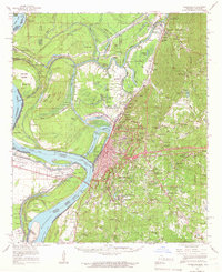
Loading map...1941 Map of Vicksburg
USGS Topo · Published 1946About this map
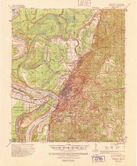
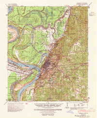
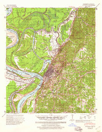
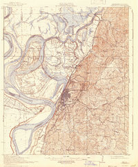
Vicksburg stands as the centerpiece of this 1941 Mississippi River Commission survey, situated at the critical junction of the Mississippi River and the Yazoo Diversion Canal. The map meticulously documents the river's complex hydrology, illustrating Centennial Lake and the various cut-offs that have reshaped the Louisiana-Mississippi border near Marshall Point and Paw Paw Bend. To the north, the landscape is defined by the Yazoo River and a network of oxbows including Eagle Lake and Long Lake.
Find a feature on this map
71 named features on this map. Tap any name to fly to it.
Don’t see what you’re looking for? This feature index may not catch every label — zoom into the map to look around manually.
Map Details
Date Portrayed1941
Date Published1946
PublisherU.S. Geological Survey
Map TypeTopographic
Scale1:62,500
Physical Dimensions17.9 x 21.8 inches
Editions of this 1941 Vicksburg Map
3 editions found
Historical Maps of Vicksburg Through Time
3 maps found
Featured Locations
Source Details
SourceU.S. Geological Survey
CopyrightPublic Domain