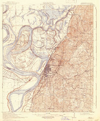
1941 Map of Vicksburg
USGS Topo · Published 1960About this map
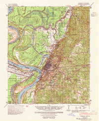
The Mississippi River and the complex hydrology of the Yazoo River delta dominate this mid-century survey of Vicksburg and its surroundings. The river's historical shifts are clearly visible in the Centennial Cut-Off 1876, which left Centennial Lake as an oxbow after a massive flood event. On the heights above the floodplain, the National Cem and All Saints College represent the established institutional presence of the city, while the industrial and military importance of the region is highlighted by the U S Waterways Experiment Sta and the Camp Williamson Miss Natl Guard Rifle Range to the south.
Find a feature on this map
80 named features on this map. Tap any name to fly to it.
Don’t see what you’re looking for? This feature index may not catch every label — zoom into the map to look around manually.
Map Details
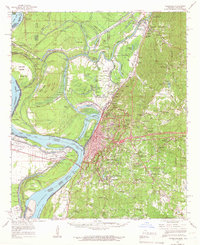
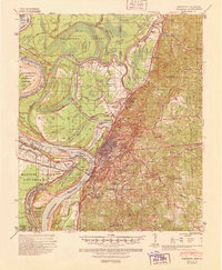
Editions of this 1941 Vicksburg Map
3 editions found
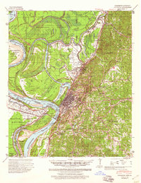
Historical Maps of Vicksburg Through Time
3 maps found