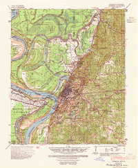
1941 Map of Vicksburg
USGS Topo · Published 1954About this map
The Vicksburg National Military Park dominates the high ground overlooking the city, preserving the intricate trench lines and battery positions that defined the 1863 siege. Below the bluffs, the Mississippi River and Yazoo River display a complex hydrologic history, marked by the Centennial Cut-Off 1876 and the Yazoo Diversion Canal, which redirected the rivers to maintain the city's status as a deep-water port. This 1941 survey captures Vicksburg as a critical hub of mid-century infrastructure, featuring the Illinois Central Railroad and the U S Waterways Experiment Sta. To the north, the map details the transition into the delta lowlands of Issaquena County, dotted with oxbow lakes like Eagle Lake and Horseshoe Lake. Local life is recorded through numerous rural landmarks, including the Fernwood Sch, Culkin Academy, and several country churches such as Pleasant Valley Ch and St Mark Ch.
Find a feature on this map
73 named features on this map. Tap any name to fly to it.
Don’t see what you’re looking for? This feature index may not catch every label — zoom into the map to look around manually.
Map Details
Editions of this 1941 Vicksburg Map
3 editions found

Other maps of this area

1909 · Millikens Bend
USGS Topo · 1:24,000

1909 · Mound
USGS Topo · 1:24,000

1910 · Mound
USGS Topo · 1:31,680

1918 · Vicksburg
USGS Topo · 1:62,500

1938 · Edwards
USGS Topo · 1:62,500

1939 · Onward
USGS Topo · 1:62,500

1939 · Talla Bena
USGS Topo · 1:62,500

1939 · Yokena
USGS Topo · 1:62,500

1939 · Alsatia
USGS Topo · 1:62,500

1940 · Mechanicsburg
USGS Topo · 1:62,500