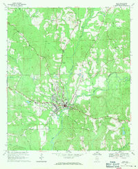
1968 Map of Elba
USGS Topo · Published 1971About this map
Elba sits at the confluence of the Pea River and Whitewater Creek in this late 1960s survey. The town's layout follows the bends of the river, with the Seaboard Coast Line railroad cutting across the southern landscape and the Elba Municipal Airport situated to the west. The surrounding Coffee County countryside is dotted with numerous rural congregations and burying grounds, including Wise Mill Ch and Evergreen Cemetery, which anchor the local community history.
Find a feature on this map
39 named features on this map. Tap any name to fly to it.
Don’t see what you’re looking for? This feature index may not catch every label — zoom into the map to look around manually.
Map Details
Editions of this 1968 Elba Map
2 editions found
Other maps of this area

1942 · Enterprise
USGS Topo · 1:125,000

1948 · Brundidge
USGS Topo · 1:62,500

1950 · Enterprise
USGS Topo · 1:62,500

1950 · Brundidge
USGS Topo · 1:62,500

1953 · Andalusia
USGS Topo · 1:250,000

1953 · Dothan
USGS Topo · 1:250,000

1954 · Dothan
USGS Topo · 1:250,000

1955 · Dothan
USGS Topo · 1:250,000

1957 · Andalusia
USGS Topo · 1:250,000

1960 · Victoria
USGS Topo · 1:24,000