2022 Map of Elberon
USGS Topo · Published 2022About this map
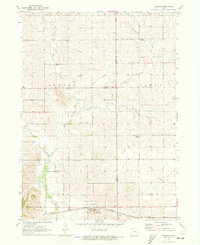
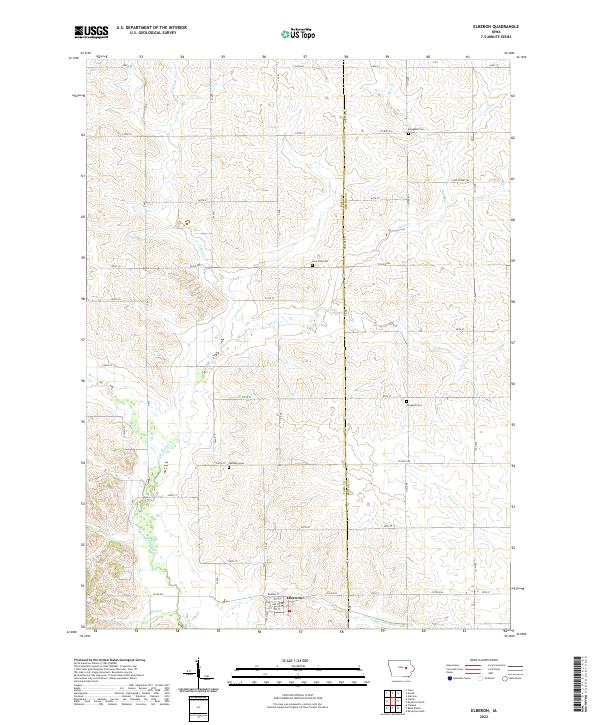
Elberon sits at the southern edge of this modern survey, where the grid of Railway St and numbered streets meets the rural expanse of southern Tama County. The landscape is defined by the drainage patterns of Salt Creek and its many tributaries, including E Br Salt Cr and Stein Cr, which carve through the agricultural sections. For those tracing local heritage, several small burial grounds are distributed across the township, including Waltham Cem, Lone Pine Cem, and Twogood Cem. These locations, along with Houghton Cem in the northeast, provide specific points of reference for genealogical research in this prairie region. The map details the modern road network, from local routes like Co Rd E44 to the section-line roads that have governed the area's development for generations, while the flow of Wolf Cr and Prairie Cr continues to shape the low-lying terrain.
Find a feature on this map
44 named features on this map. Tap any name to fly to it.
Don’t see what you’re looking for? This feature index may not catch every label — zoom into the map to look around manually.
Map Details
Editions of this 2022 Elberon Map
This is the sole edition of this map. No revisions or reprints were ever made.