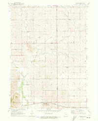
1971 Map of Elberon
USGS Topo · Published 1973About this map
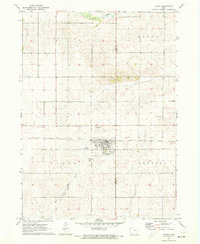
Elberon sits at the southern edge of this 1970s landscape, serving as a focal point for the surrounding agricultural townships of Oneida, Homer, York, and Kane. The town is bisected by the Chicago Milwaukee St Paul and Pacific railroad, which runs parallel to the aptly named Troublesome Creek. The area's rural character is defined by a dense network of watercourses including Stein Creek, Prairie Creek, and Salt Creek, along with several family-named burial grounds that provide significant value for genealogical research. These include Houghton Cem, Lamprecht Cem, Toogood Cem, and Walthom Cem, scattered across the rolling terrain between the Tama and Benton County line. The distribution of these cemeteries and the winding paths of the local creeks illustrate the historical settlement patterns of this central Iowa region before modern development altered the farm-to-market landscape.
Find a feature on this map
18 named features on this map. Tap any name to fly to it.
Don’t see what you’re looking for? This feature index may not catch every label — zoom into the map to look around manually.
Map Details
Editions of this 1971 Elberon Map
This is the sole edition of this map. No revisions or reprints were ever made.
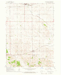
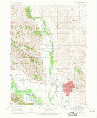
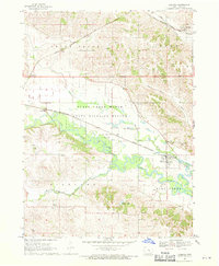
Other maps of this area

1954 · Waterloo
USGS Topo · 1:250,000

1954 · Des Moines
USGS Topo · 1:250,000

1955 · Waterloo
USGS Topo · 1:250,000

1956 · Des Moines
USGS Topo · 1:250,000

1957 · Des Moines
USGS Topo · 1:250,000
1965 · Keystone South
USGS Topo · 1:24,000
1968 · Belle Plaine
USGS Topo · 1:24,000
1968 · Chelsea
USGS Topo · 1:24,000

1969 · Des Moines
USGS Topo · 1:250,000
1971 · Dysart
USGS Topo · 1:24,000