
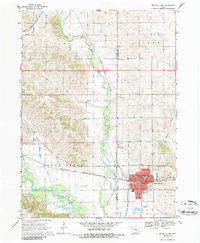
1968 Map of Belle Plaine
USGS Topo · Published 1970About this map
The Iowa River corridor dominates the southern portion of this landscape, its wide floodplain giving way to the meandering Salt Creek and the municipal center of Belle Plaine. Published in 1970 from data checked in the late 1960s, this survey documents the rail-oriented layout of the town, where the Chicago and North Western lines intersect the local street grid. The community infrastructure is well-defined, showing the locations of Lincoln School and Longfellow School, as well as the sewage disposal site and the Belle Plaine Landing Strip.
Find a feature on this map
35 named features on this map. Tap any name to fly to it.
Don’t see what you’re looking for? This feature index may not catch every label — zoom into the map to look around manually.
Map Details
Editions of this 1968 Belle Plaine Map
2 editions found
Other maps of this area

1954 · Waterloo
USGS Topo · 1:250,000

1954 · Des Moines
USGS Topo · 1:250,000

1955 · Waterloo
USGS Topo · 1:250,000

1956 · Des Moines
USGS Topo · 1:250,000

1957 · Des Moines
USGS Topo · 1:250,000

1965 · Ladora
USGS Topo · 1:24,000

1965 · Keystone South
USGS Topo · 1:24,000

1968 · Belle Plaine SW
USGS Topo · 1:24,000

1968 · Chelsea
USGS Topo · 1:24,000

1968 · Hartwick
USGS Topo · 1:24,000