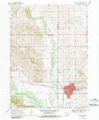
1968 Map of Belle Plaine
USGS Topo · Published 1986About this map
The Iowa River valley dominates the southern reaches of this landscape, where the Salt Creek confluence meets the floodplain just west of Belle Plaine. This 1960s era survey captures the town's industrial and civic footprint, including the Chicago and North Western rail yards and local institutions like Williams Park and the Longfellow Sch. To the north, the terrain transitions into the rolling hills of York and Kane townships, marked by a high density of rural burial grounds such as St Marys Cem and the National Cem. The presence of a Gaging Station and several Wells along the creek beds highlights the region's reliance on its waterway network. Transportation routes converge on the settlement, with an Old Railroad Grade and 21 tracing the historical paths of commerce and travel through Benton Co and Tama Co.
Find a feature on this map
47 named features on this map. Tap any name to fly to it.
Don’t see what you’re looking for? This feature index may not catch every label — zoom into the map to look around manually.
Map Details
Editions of this 1968 Belle Plaine Map
2 editions found
Other maps of this area

1954 · Waterloo
USGS Topo · 1:250,000

1954 · Des Moines
USGS Topo · 1:250,000

1955 · Waterloo
USGS Topo · 1:250,000

1956 · Des Moines
USGS Topo · 1:250,000

1957 · Des Moines
USGS Topo · 1:250,000

1965 · Ladora
USGS Topo · 1:24,000

1965 · Keystone South
USGS Topo · 1:24,000

1968 · Belle Plaine SW
USGS Topo · 1:24,000

1968 · Belle Plaine
USGS Topo · 1:24,000

1968 · Chelsea
USGS Topo · 1:24,000