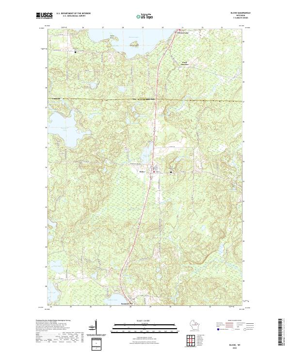
2022 Map of Elcho
USGS Topo · Published 2022About this map
The Hunting River meanders through this heavily glaciated landscape in the Wisconsin Northwoods, connecting a dense network of water bodies and marshlands. The settlement of Elcho sits centrally along the north-south transit corridor, serving as a local hub near the Elcho Community Cem. To the north, the southern reaches of Pelican Lake dominate the terrain, featuring Guths Bay and the distinctive Antigo Island. This region, split by the Oneida Co Langlade Co line, reflects a landscape shaped by water and woods, where local roads like Moccasin Lake Rd and Enterprise Lake Rd provide access to numerous recreational lakes such as Enterprise Lake, Silver Lake, and Otter Lake. Local history is anchored by the community at Summit Lake and the smaller gathering point at Pratt Junction, while the Enterprise Cem stands as a quiet record of earlier generations in this lake-bound geography.
Find a feature on this map
85 named features on this map. Tap any name to fly to it.
Don’t see what you’re looking for? This feature index may not catch every label — zoom into the map to look around manually.
Map Details
Editions of this 2022 Elcho Map
This is the sole edition of this map. No revisions or reprints were ever made.
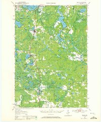
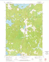
Historical Maps of Elcho Through Time
4 maps found