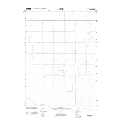
2011 Map of Elgin NW
USGS Topo · Published 2011About this map
Stoltz Reservoir and the engineered Stoltz Dam serve as the central landmarks in this agricultural portion of Antelope County. The landscape is defined by the rigid geometry of the Nebraska Section Line road system, with gravel routes like 514 Ave and 837th Rd carving the prairie into precise farm plots. This infrastructure reflects the high-modern era of plains land management, where natural drainage systems such as Beaver Creek and Rae Creek are integrated into a highly controlled network of irrigation and transport. Researchers of local land use will find a clear record of the rural homestead pattern, showing how individual farmstead access points are distributed across the grid. The map records a moment in the early 21st century when the traditional agricultural layout remained largely unchanged, even as water management through damming became more prevalent.
Find a feature on this map
16 named features on this map. Tap any name to fly to it.
Don’t see what you’re looking for? This feature index may not catch every label — zoom into the map to look around manually.
Map Details
Editions of this 2011 Elgin NW Map
This is the sole edition of this map. No revisions or reprints were ever made.
Other maps of this area

1955 · Broken Bow
USGS Topo · 1:250,000

1955 · O'Neill
USGS Topo · 1:250,000

1956 · Broken Bow
USGS Topo · 1:250,000

1959 · O'Neill
USGS Topo · 1:250,000

1960 · Spalding 2 NE
USGS Topo · 1:24,000

1960 · Spalding 2 SE
USGS Topo · 1:24,000

1963 · Petersburg
USGS Topo · 1:24,000

1963 · Neligh SE
USGS Topo · 1:24,000

1963 · Deloit
USGS Topo · 1:24,000

1963 · Neligh SW
USGS Topo · 1:24,000