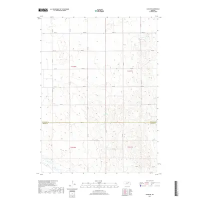
2017 Map of Elgin NW
USGS Topo · Published 2017About this map
The rolling agricultural landscape along the Antelope Co and Boone Co line is defined by a dense grid of section roads and small watercourses. This 2017 survey reveals the intricate local drainage patterns of the northeast Nebraska plains, where seasonal flows like Rae Creek and Beaver Creek cut through the terrain. The presence of Stultz Reservoir centrally located in the quadrangle highlights the importance of water management in this farming region. The map provides a detailed record of the township system, marking the boundaries between t23n r8w, t23n r7w, t22n r8w, and t22n r7w. Genealogists and local historians can use the road network, including 190th Ave and North St, to precisely locate former homesteads and land holdings within this rural section of the state.
Find a feature on this map
27 named features on this map. Tap any name to fly to it.
Don’t see what you’re looking for? This feature index may not catch every label — zoom into the map to look around manually.
Map Details
Editions of this 2017 Elgin NW Map
This is the sole edition of this map. No revisions or reprints were ever made.
Other maps of this area

1955 · Broken Bow
USGS Topo · 1:250,000

1955 · O'Neill
USGS Topo · 1:250,000

1956 · Broken Bow
USGS Topo · 1:250,000

1959 · O'Neill
USGS Topo · 1:250,000

1960 · Spalding 2 NE
USGS Topo · 1:24,000

1960 · Spalding 2 SE
USGS Topo · 1:24,000

1963 · Petersburg
USGS Topo · 1:24,000

1963 · Neligh SE
USGS Topo · 1:24,000

1963 · Deloit
USGS Topo · 1:24,000

1963 · Neligh SW
USGS Topo · 1:24,000