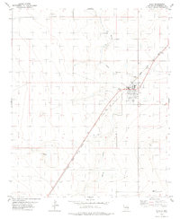
1978 Map of Elida
USGS Topo · Published 1979About this map
Elida serves as the central hub of this High Plains landscape, organized around the diagonal path of the Atchison Topeka and Santa Fe railroad. The town's grid is clearly defined by streets such as Main St, Railroad Ave, and South Ave, which reflect a community built on the logistics of the rail line. Social and recreational life is evidenced by the Rodeo Ground and Athletic Field located on the town's western edge.
Find a feature on this map
18 named features on this map. Tap any name to fly to it.
Don’t see what you’re looking for? This feature index may not catch every label — zoom into the map to look around manually.
Map Details
Editions of this 1978 Elida Map
This is the sole edition of this map. No revisions or reprints were ever made.
Other maps of this area

1954 · Clovis
USGS Topo · 1:250,000

1954 · Brownfield
USGS Topo · 1:250,000

1958 · Brownfield
USGS Topo · 1:250,000

1958 · Clovis
USGS Topo · 1:250,000

1962 · Brownfield
USGS Topo · 1:250,000

1973 · Lewiston Lake
USGS Topo · 1:24,000

1973 · Gammil Well SE
USGS Topo · 1:24,000

1973 · Floyd SE
USGS Topo · 1:24,000
1979 · Badger Lake
USGS Topo · 1:24,000

1979 · Kenna
USGS Topo · 1:24,000