
Historical Maps of New Mexico
What stories do these 4,920 old maps tell about New Mexico's past? From 1883 to present day, these maps reveal the evolution of streets, neighborhoods, iconic landmarks, and natural features in stunning high-res detail. Whether you're a history enthusiast, genealogist, or professional in education, environmental work, or architecture, these maps are perfect for exploration, research, and discovery.
Discover New Mexico's history through maps:
- Trace New Mexico's growth: Explore earlier and latest maps and editions to uncover how the region changed over time.
- Examine technical details: Each map includes its creators, publishers, scale, dimensions, and full source information.
- Layer maps with modern tools & imagery: Compare historical maps to modern-day with high-resolution satellite imagery and detailed LiDAR layers.
- Sourced from trusted archives: Carefully preserved and digitized by institutions like the United Stated Geological Survey and the US Library of Congress.
- Access in any format: View and explore in high resolution, download for offline use, or order a museum-quality print for yourself or a loved one.
Begin your journey into New Mexico's history with these remarkable must-see maps.
New Mexico maps
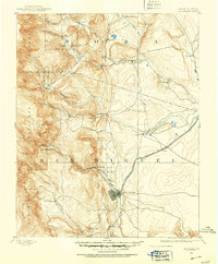
(4,920)- 1883 Map of Mt. Taylor
 1883 Mt. Taylor1883 Print · USGSCovers New Mexico, including Grants, Milan, and other nearby areas
 - 1886 Map of St Johns
 1886 St Johns1886 Print · USGSCovers New Mexico, including Show Low, Pinetop-Lakeside, and other nearby areas
 - 1886 Map of Wingate
 1886 Wingate1886 Print · USGSCovers New Mexico, including Gallup, Fort Defiance Agency, and other nearby areas
 - 1886 Map of Mt. Taylor
 1886 Mt. Taylor1886 Print · USGSCovers New Mexico, including Grants, Milan, and other nearby areas
 - 1886 Map of Fort Defiance
 1886 Fort Defiance1886 Print · USGSCovers New Mexico, including Chinle Agency, Fort Defiance Agency, and other nearby areas
 - 1888 Map of Bernalillo, 1951 Print
 1888 Bernalillo1951 Print · USGSCovers New Mexico, including Albuquerque, Rio Rancho, and other nearby areas
 - 1889 Map of Albuquerque
 1889 Albuquerque1889 Print · USGSCovers New Mexico, including Albuquerque, Rio Rancho, and other nearby areas
 - 1889 Map of Largo
 1889 Largo1889 Print · USGSCovers New Mexico, including Bloomfield, Aztec, and other nearby areas
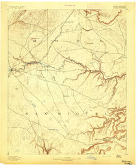
 - 1889 Map of Chaco
 1889 Chaco1889 Print · USGSCovers New Mexico, including Farmington, Shiprock Agency, and other nearby areas
 - 1889 Map of Las Vegas, 1953 Print
 1889 Las Vegas1953 Print · USGSCovers New Mexico, including Las Vegas, Mora, and other nearby areas
 - 1889 Map of Santa Fe, 1963 Print
 1889 Santa Fe1963 Print · USGSCovers New Mexico, including Santa Fe, Pecos, and other nearby areas
 - 1890 Map of Jemes
 1890 Jemes1890 Print · USGSCovers New Mexico, including Jemez Springs, San Ysidro, and other nearby areas
 - 1890 Map of Jemes, 1898 Print
 1890 Jemes1898 Print · USGSCovers New Mexico, including Jemez Springs, San Ysidro, and other nearby areas
 - 1890 Map of Bernal, 1956 Print
 1890 Bernal1956 Print · USGSCovers New Mexico, including Upper Dilia, Serafina, and other nearby areas
 - 1891 Map of Bernal
 1891 Bernal1891 Print · USGSCovers New Mexico, including Upper Dilia, Serafina, and other nearby areas
 - 1891 Map of Las Cruces
 1891 Las Cruces1891 Print · USGSCovers New Mexico, including El Paso, Las Cruces, and other nearby areas
 - 1891 Map of Las Vegas
 1891 Las Vegas1891 Print · USGSCovers New Mexico, including Las Vegas, Mora, and other nearby areas
 - 1892 Map of San Pedro
 1892 San Pedro1892 Print · USGSCovers New Mexico, including Albuquerque, Edgewood, and other nearby areas
 - 1892 Map of Fort Defiance
 1892 Fort Defiance1892 Print · USGSCovers New Mexico, including Chinle Agency, Fort Defiance Agency, and other nearby areas
 - 1892 Map of Jemes
 1892 Jemes1892 Print · USGSCovers New Mexico, including Jemez Springs, San Ysidro, and other nearby areas
 - 1892 Map of Santa Clara
 1892 Santa Clara1892 Print · USGSCovers New Mexico, including Santa Fe, Los Alamos, and other nearby areas
 - 1892 Map of St Johns
 1892 St Johns1892 Print · USGSCovers New Mexico, including Show Low, Pinetop-Lakeside, and other nearby areas
 - 1892 Map of Watrous
 1892 Watrous1892 Print · USGSCovers New Mexico, including Wagon Mound, Ciruela, and other nearby areas
 - 1892 Map of Corazon
 1892 Corazon1892 Print · USGSCovers New Mexico, including Trementina, Salitre, and other nearby areas
 - 1892 Map of Wingate
 1892 Wingate1892 Print · USGSCovers New Mexico, including Gallup, Fort Defiance Agency, and other nearby areas
Showing maps 1-25 of 4,920
Top cities in New Mexico
- Albuquerque historical maps
- Las Cruces historical maps
- Rio Rancho historical maps
- Santa Fe historical maps
- Roswell historical maps
- Farmington historical maps
See more
Top counties in New Mexico
- Bernalillo County historical maps
- Doña Ana County historical maps
- Santa Fe County historical maps
- Sandoval County historical maps
- San Juan County historical maps
- McKinley County historical maps
See more
Frequently asked questions
- What are the different types of historical maps available for New Mexico?
- What is the oldest map of New Mexico?
- Where can I purchase historical maps of New Mexico for my home or office?
- Where can I download high-res historical maps of New Mexico?
- Are there historical topographic maps available for New Mexico?
- Is there historical aerial imagery available for New Mexico?
- Where are historical maps of New Mexico sourced from?