Old Maps of Valencia County, New Mexico
Explore 209 old maps of Valencia County, spanning from 1916 to today. These high-resolution historic maps reveal how streets, neighborhoods, landmarks, and natural features evolved over time — perfect for genealogy, metal detecting, research, and local history exploration.
What you can do with these maps:
- See how Valencia County changed over time: Compare historical maps to modern-day views to trace roads, homesites, rail lines & more.
- View detailed metadata: Each map includes creators, publishers, year, scale, and archive source.
- Overlay maps with satellite & LiDAR: Visualize the past alongside modern tools to explore terrain & human change.
- Trusted historical sources: Maps sourced from the USGS, Library of Congress, and other archives.
- Access maps your way: View online, download high-res files, or order prints for personal or research use.
Start exploring old maps of Valencia County to uncover forgotten places, hidden landmarks, and the deep history beneath your feet.
Valencia County, NM maps
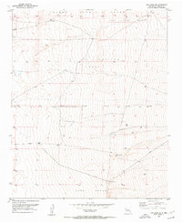
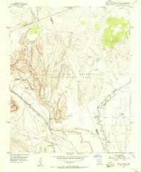
(209)- 1916 Map of La Joya
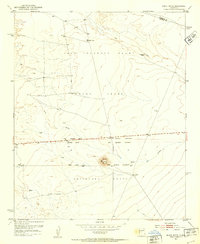
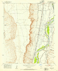
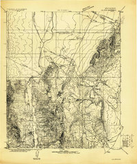 1916 La Joya1916 Print · USGSThe Rio Grande valley at the time of the Belen Cut Off's construction reveals a landscape of massive Spanish land grants and new rail towns. Trace early settlements like La Joya and Becker or geological landmarks like Pyramid Crater.
 - 1917 Map of Estancia
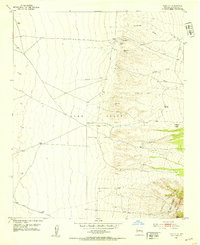
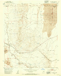
 1917 Estancia1917 Print · USGSThe Estancia Valley and Manzano foothills come alive in this Great War-era survey, showing a landscape defined by massive land grants and new rail lines. Trace family roots and vanished ranch sites across the Manzano Grant or locate early buildings in Mountainair, Willard, and Chilili.
 - 1917 Map of Cerro Verde
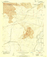
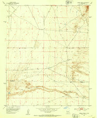
 1917 Cerro Verde1917 Print · USGSNorthwestern New Mexico’s high desert landscape is captured here during the First World War era, showing a mix of ancient land grants and rail-side outposts. Genealogists and historians can trace family-named sites like Vigil, Baca, and the Correo Post Office along the Atchison Topeka and Santa Fe line.
 - 1952 Map of Dalies, 1953 Print
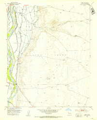
 1952 Dalies1953 Print · USGSThe high desert south of Albuquerque was a land of sprawling rail junctions and historic land grants in the early fifties. Genealogists and historians can trace the rail networks at Dalies or locate the New Mexico Penitentiary Farm and El Cerro de los Lunas.2 unique versions available
 - 1952 Map of Tome SE, 1953 Print
 1952 Tome SE1953 Print · USGSValencia County in the early fifties is captured here as a landscape of historic land grants and high desert terrain. Researchers can trace the formal boundaries of the Tome Grant and find isolated water sources like North Well and Mountain Well.4 unique versions available
 - 1952 Map of Belen SW, 1953 Print
 1952 Belen SW1953 Print · USGSThe high desert west of the Rio Grande is captured here in the early 1950s, showing a landscape defined by ranching and traditional land grants. Trace the boundaries of the Belen Grant and locate water sources like Pedro Draw and Coyote Draw.
 - 1952 Map of Black Butte, 1953 Print
 1952 Black Butte1953 Print · USGSCentral New Mexico is captured here in the early fifties, focusing on the vast desert land grants south of Belen. Researchers can trace the massive boundaries of the Casa Colorado Grant and Sevilleta Grant near Black Butte.2 unique versions available
 - 1952 Map of Tome NE, 1953 Print
 1952 Tome NE1953 Print · USGSValencia County at the start of the fifties is captured here as a landscape of historic land grants and essential desert springs. Researchers can locate the western slopes of the Manzano Mountains and trace local water sources like Ojo Alamo and Ojo Jodiondilla.4 unique versions available
 - 1952 Map of Belen, 1953 Print
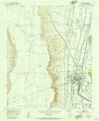 1952 Belen1953 Print · USGSBelen and its surrounding land grants are shown in meticulous detail during the early fifties, capturing the intersection of railroad industry and river valley agriculture. Genealogists and local historians can locate Our Lady of Belen Cem, the rail lines of the Atchison Topeka and Santa Fe, and the old neighborhoods of Los Trujillos.3 unique versions available
 - 1952 Map of Turn, 1953 Print
 1952 Turn1953 Print · USGSValencia County in the early 1950s is shown as a corridor of river-fed agriculture and rail transit. Genealogists and local historians can trace the community around Turn, the Casa Colorada School, and the Cem near the banks of the Rio Grande.3 unique versions available
 - 1952 Map of Veguita, 1953 Print
 1952 Veguita1953 Print · USGSThe Rio Grande valley in the early fifties shows a vibrant agricultural corridor shaped by centuries of land grants. Genealogists and historians can trace family-named landmarks and rural life in Sabinal, Bosque, and Jarales along the historic El Camino Real.3 unique versions available
 - 1952 Map of Belen NW, 1953 Print
 1952 Belen NW1953 Print · USGSValencia County was a landscape of expansive ranching and desert land grants in the early fifties. Genealogists and historians can trace the borders of the Nicolas Duran De Chavez Grant and locate water landmarks like the Shearing Corral Windmill and Guzman Reservoir.3 unique versions available
 - 1952 Map of Rio Puerco, 1953 Print
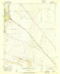
 1952 Rio Puerco1953 Print · USGSSpanish land grants still shaped the landscape of central New Mexico during the early fifties. Genealogists and historians can trace property lines through the San Clemente Grant and locate the small riverside stop of Rio Puerco near the Atchison Topeka and Santa Fe railroad.2 unique versions available
 - 1952 Map of Hubbell Spring, 1953 Print
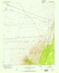
 1952 Hubbell Spring1953 Print · USGSThe Isleta Pueblo region in the early fifties shows a rugged landscape of ranching and early aviation infrastructure. Researchers can trace the boundaries of Mc Cormick Ranch and locate remote landmarks like Hubble Spring and the Ojo de la Cabra spring.4 unique versions available
 - 1952 Map of Tome, 1953 Print
 1952 Tome1953 Print · USGSThe Rio Grande valley south of Albuquerque was a hub of traditional irrigation and land grant settlements in the early fifties. Genealogists and historians can trace the family-named communities of Tome, Adelino, and La Constancia alongside the AT & SF rail line.3 unique versions available
 - 1952 Map of Los Lunas SE, 1953 Print
 1952 Los Lunas SE1953 Print · USGSValencia County land grants and desert springs characterize this early 1950s survey of the New Mexico territory. Local historians and genealogists can trace the boundaries of the Juan Otero Grant and find isolated landmarks like Maes Spring or the Windmill.2 unique versions available
 - 1952 Map of Becker, 1953 Print
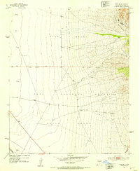
 1952 Becker1953 Print · USGSThe high desert of Socorro County in the early fifties shows the intersection of the Atchison Topeka and Santa Fe rail line and massive Spanish land grants. Researchers can trace the ranching history of West and Pyle Ranch and industrial sites like the Santa Fe Quarry.2 unique versions available
 - 1952 Map of Los Lunas, 1954 Print
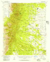
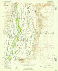 1952 Los Lunas1954 Print · USGSThe Rio Grande valley comes alive in this mid-century survey of Valencia County, showing the intricate network of canals and historic land grants. Genealogists can locate family landmarks like Romero Ranch, El Camposanto de la Liverta, and the Chical Indian School.3 unique versions available
 - 1952 Map of Isleta, 1954 Print
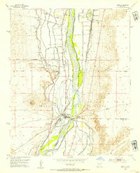 1952 Isleta1954 Print · USGSThe Rio Grande valley south of Albuquerque was a complex network of irrigation and transit in the early fifties. Local historians can trace the foundations of Pajarito and Isleta Pueblo alongside landmarks like St Andres Ch and the Isleta Diversion Dam.3 unique versions available
 - 1954 Map of South Garcia, 1955 Print
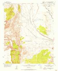
 1954 South Garcia1955 Print · USGSThe high desert of Valencia County in the mid-1950s is defined here by tribal lands and cattle ranching. Trace early landmarks like the Antonio Sedillo Grant Headquarters and the Atchison Topeka and Santa Fe railroad.2 unique versions available
 - 1954 Map of Bosque Peak, 1955 Print
 1954 Bosque Peak1955 Print · USGSThe Manzano Mountains and historic land grants define this New Mexico landscape in the mid-fifties. Researchers can trace the boundaries of the Isleta Indian Reservation and locate remote landmarks like Fourth of July Spring or Bosque Peak.3 unique versions available
 - 1954 Map of Capilla Peak, 1955 Print
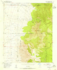
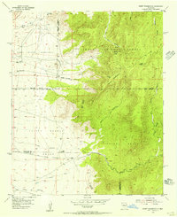
 1954 Capilla Peak1955 Print · USGSThe Manzano Mountains during the mid-fifties reveal a rugged landscape of high-altitude lookouts and deep canyons on the border of Torrance and Valencia counties. Genealogists and historians can trace the Crest Trail and locate the former site of McKinley Place (Aband).4 unique versions available
 - 1954 Map of South Garcia SE, 1955 Print
 1954 South Garcia SE1955 Print · USGSValencia County land and tribal grants are captured here in the mid-fifties, dominated by the sweeping desert terrain of the Laguna Indian Reservation. Genealogists and historians can trace the Atchison Topeka and Santa Fe rail line and locate ancient sites including several Indian Ruins.3 unique versions available
 - 1954 Map of Mount Washington, 1955 Print
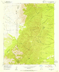
 1954 Mount Washington1955 Print · USGSThe Manzano Mountains and the Isleta Pueblo are captured here in the mid-1950s, showing a landscape defined by federal land and indigenous heritage. Trace the transition from the Sandia Military Reservation to landmarks like the Manzano Lookout Tower and Coyote Springs.4 unique versions available
 - 1954 Map of Torreon, 1957 Print
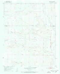
 1954 Torreon1957 Print · USGSThe foothills of the Manzano Mountains in the mid-fifties reveal a landscape of ancient Spanish land grants and scattered family homesteads. Genealogists can locate specific family sites like Vigil Place or Sanchez Place and trace the proximity of Quarai Ruins State Mon.2 unique versions available
Showing maps 1-25 of 209
Top cities of Valencia County
- Los Lunas historical maps
- Belen historical maps
- Rio Communities historical maps
- Bosque Farms historical maps
- Peralta historical maps
Frequently asked questions
- What are the different types of historical maps available for Valencia County?
- What is the oldest map of Valencia County?
- Where can I purchase historical maps of Valencia County for my home or office?
- Where can I download high-res historical maps of Valencia County?
- Are there historical topographic maps available for Valencia County?
- Is there historical aerial imagery available for Valencia County?
- Where are historical maps of Valencia County sourced from?