
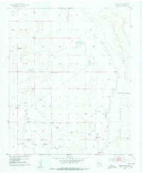
1952 Map of Belen NW
USGS Topo · Published 1953About this map
The Nicolas Duran De Chavez Grant dominates this arid landscape west of the Rio Grande, where the winding course of the Rio Puerco carves through the terrain. In the early 1950s, this area was defined by a sparse ranching infrastructure essential for survival in the high desert. Scattered windmills like the Pueblo Windmill, Popalito Windmill, and the Shearing Corral Windmill provided critical water sources, while a series of catchment basins including Guzman Reservoir and Gabaladon Reservoir managed seasonal runoff. The topography is marked by the Monte Belen Arroyo and diverse smaller features like Metate Reservoir and Escondido Reservoir. This survey highlights the complex land grant boundaries and the reliance on localized water management systems during the mid-century era, illustrating how the natural drainage of the Rio Puerco basin dictated the placement of livestock improvements and boundary lines.
Find a feature on this map
12 named features on this map. Tap any name to fly to it.
Don’t see what you’re looking for? This feature index may not catch every label — zoom into the map to look around manually.
Map Details
Editions of this 1952 Belen NW Map
Other maps of this area

1917 · Cerro Verde
USGS Topo · 1:125,000

1952 · Dalies
USGS Topo · 1:24,000

1952 · Belen SW
USGS Topo · 1:24,000

1952 · Belen
USGS Topo · 1:24,000

1952 · Veguita
USGS Topo · 1:24,000

1952 · Rio Puerco
USGS Topo · 1:24,000

1954 · South Garcia SE
USGS Topo · 1:24,000

1954 · Socorro
USGS Topo · 1:250,000

1956 · South Garcia
USGS Topo · 1:62,500

1956 · Mesa Aparejo
USGS Topo · 1:62,500