
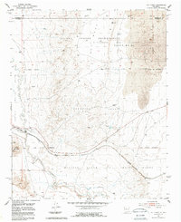
1952 Map of Rio Puerco
USGS Topo · Published 1953About this map
San Clemente Grant and other expansive Spanish land grants define the legal and physical geography of this arid New Mexico landscape. The winding course of the Rio Puerco serves as a critical hydrologic spine, shadowed by the prominent rise of Hidden Mountain and the high flats of Cat Mesa. This 1952 survey shows a region where traditional landholdings meet industrial transit, as the Atchison Topeka and Santa Fe railroad cuts across the valley floor. The small settlement of Rio Puerco sits near a crucial Gaging Station, illustrating the importance of water management in a territory partitioned by the Isleta Pueblo Grant Boundary and the Nicolas Duran de Chavez Grant. The map captures a moment when large-scale land tenure systems remained the dominant structural feature of the Rio Puerco valley.
Find a feature on this map
12 named features on this map. Tap any name to fly to it.
Don’t see what you’re looking for? This feature index may not catch every label — zoom into the map to look around manually.
Map Details
Editions of this 1952 Rio Puerco Map
2 editions found
Other maps of this area

1917 · Cerro Verde
USGS Topo · 1:125,000

1952 · Wind Mesa
USGS Topo · 1:24,000

1952 · Dalies
USGS Topo · 1:24,000

1952 · Belen
USGS Topo · 1:24,000

1952 · Belen NW
USGS Topo · 1:24,000

1952 · Dalies NW
USGS Topo · 1:24,000

1954 · South Garcia
USGS Topo · 1:24,000

1954 · South Garcia SE
USGS Topo · 1:24,000

1954 · Socorro
USGS Topo · 1:250,000

1956 · South Garcia
USGS Topo · 1:62,500