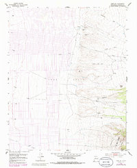
1952 Map of Tome NE
USGS Topo · Published 1996About this map
The Tome Grant defines the center of this landscape, showing a planned grid of residential expansion pushing eastward toward the high desert. To the east, the topography shifts abruptly into the foothills of the Manzano Mountains, where the modern street layout gives way to traditional water sources and natural drainage systems. Several springs, or ojos, are identified along the base of the mountains, including Ojo Alamo, Ojo Huelos, and Ojo Jediondilla, which historically provided vital water for livestock in this arid environment.
Find a feature on this map
15 named features on this map. Tap any name to fly to it.
Don’t see what you’re looking for? This feature index may not catch every label — zoom into the map to look around manually.
Map Details
Editions of this 1952 Tome NE Map
4 editions found
Other maps of this area

1917 · Estancia
USGS Topo · 1:125,000

1952 · Tome SE
USGS Topo · 1:24,000

1952 · Tome NE
USGS Topo · 1:24,000

1952 · Turn
USGS Topo · 1:24,000

1952 · Tome
USGS Topo · 1:24,000

1952 · Los Lunas SE
USGS Topo · 1:24,000

1952 · Los Lunas
USGS Topo · 1:24,000

1954 · Bosque Peak
USGS Topo · 1:24,000

1954 · Capilla Peak
USGS Topo · 1:24,000

1954 · Torreon
USGS Topo · 1:62,500