
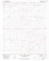
1952 Map of Los Lunas SE
USGS Topo · Published 1953About this map
Isleta Pueblo Grant and the Juan Otero Grant dominate this mid-century topographic survey of the New Mexico landscape east of the Rio Grande. The area is defined by massive land grants, including the Lo De Padilla Grant and Tome Grant, which reflect the region's complex history of land tenure. Though largely arid and marked by desert terrain, the presence of life-sustaining water sources like Maes Spring and Carrizo Spring underscores the traditional importance of these locations for ranching and travel. A few man-made improvements are scattered throughout the territory, such as a Windmill and various wells, including one noted as a Well (Dry). The survey, based on 1947 aerial photography and 1952 field work, provides a precise look at the drainage patterns and elevation markers like the VABM Lolito triangulation station, offering a detailed record of the open range before modern development.
Find a feature on this map
13 named features on this map. Tap any name to fly to it.
Don’t see what you’re looking for? This feature index may not catch every label — zoom into the map to look around manually.
Map Details
Editions of this 1952 Los Lunas SE Map
2 editions found
Other maps of this area

1917 · Estancia
USGS Topo · 1:125,000

1952 · Tome NE
USGS Topo · 1:24,000

1952 · Hubbell Spring
USGS Topo · 1:24,000

1952 · Tome
USGS Topo · 1:24,000

1952 · Los Lunas
USGS Topo · 1:24,000

1952 · Isleta
USGS Topo · 1:24,000

1954 · Bosque Peak
USGS Topo · 1:24,000

1954 · Capilla Peak
USGS Topo · 1:24,000

1954 · Mount Washington
USGS Topo · 1:24,000

1954 · Torreon
USGS Topo · 1:62,500