
1954 Map of Bosque Peak
USGS Topo · Published 1955About this map
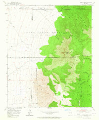
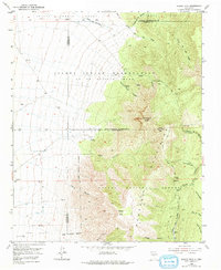
The Manzano Mountains dominate this mid-century landscape, where the high ridges of Bosque Peak and Guadalupe Peak overlook a complex network of historic land grants. Significant portions of the territory are defined by the Isleta Pueblo Grant and the Isleta Indian Reservation (Lo de Padilla Grant), alongside the northern reaches of the Tome Grant. The rugged terrain is carved by numerous deep canyons, including Cañon de los Moyos and Ojito Canyon, which provide natural drainage through the Cibola National Forest. Isolated water sources such as Fourth of July Spring and White Rock Spring appear as critical landmarks for travelers using the Tajique Trail or the Mosca Trail. This survey captures the intersection of three counties—Valencia, Bernalillo, and Torrance—at a time when the area remained primarily a wilderness of ranching and forest management, marked only by scattered windmills and a few vital springs.
Find a feature on this map
43 named features on this map. Tap any name to fly to it.
Don’t see what you’re looking for? This feature index may not catch every label — zoom into the map to look around manually.
Map Details
Editions of this 1954 Bosque Peak Map
3 editions found
Other maps of this area

1917 · Estancia
USGS Topo · 1:125,000

1952 · Tome NE
USGS Topo · 1:24,000

1952 · Hubbell Spring
USGS Topo · 1:24,000

1952 · Los Lunas SE
USGS Topo · 1:24,000

1954 · Capilla Peak
USGS Topo · 1:24,000

1954 · Mount Washington
USGS Topo · 1:24,000

1954 · Torreon
USGS Topo · 1:24,000

1954 · Tajique
USGS Topo · 1:24,000

1954 · Escabosa
USGS Topo · 1:24,000

1954 · Torreon
USGS Topo · 1:62,500