
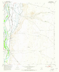
1952 Map of Tome
USGS Topo · Published 1953About this map
Rio Grande irrigation networks define this early 1950s landscape, where a complex system of acequias and drains supports life in the Rio Abajo region. Small agricultural settlements like Tome, Adelino, and La Constancia are clustered along the valley floor, their layouts dictated by the path of the Tome Main Canal and the Peralta Main Canal. The presence of the Adelino School and the Tome Cemetery near the base of El Cerro highlights the established community roots of these Hispanic land grant settlements.
Find a feature on this map
35 named features on this map. Tap any name to fly to it.
Don’t see what you’re looking for? This feature index may not catch every label — zoom into the map to look around manually.
Map Details
Editions of this 1952 Tome Map
3 editions found
Other maps of this area

1952 · Dalies
USGS Topo · 1:24,000

1952 · Tome SE
USGS Topo · 1:24,000

1952 · Tome NE
USGS Topo · 1:24,000

1952 · Belen
USGS Topo · 1:24,000

1952 · Turn
USGS Topo · 1:24,000

1952 · Veguita
USGS Topo · 1:24,000

1952 · Los Lunas SE
USGS Topo · 1:24,000

1952 · Los Lunas
USGS Topo · 1:24,000

1954 · Socorro
USGS Topo · 1:250,000

1958 · Socorro
USGS Topo · 1:250,000