
1952 Map of Isleta
USGS Topo · Published 1954About this map
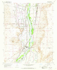
The Rio Grande corridor south of Albuquerque is defined by an intricate network of irrigation and infrastructure in the early 1950s. The landscape is a patchwork of traditional settlements and agricultural engineering, where the Isleta Canal, Arenal Canal, and Barr Canal divert water through the valley. Central to this system is the Isleta Diversion Dam, which manages the river's flow near Isleta Pueblo. This era shows the convergence of ancient paths and modern transit, with El Camino Real and the Pan-American Central Highway running parallel to the Atchison Topeka and Santa Fe railroad tracks.
Find a feature on this map
40 named features on this map. Tap any name to fly to it.
Don’t see what you’re looking for? This feature index may not catch every label — zoom into the map to look around manually.
Map Details
Editions of this 1952 Isleta Map
Other maps of this area

1888 · Bernalillo
USGS Topo · 1:125,000

1889 · Albuquerque
USGS Topo · 1:125,000

1893 · Albuquerque
USGS Topo · 1:125,000

1934 · West Albuquerque
USGS Topo · 1:24,000

1934 · East Albuquerque
USGS Topo · 1:24,000

1938 · Albuquerque
USGS Topo · 1:62,500

1952 · Wind Mesa
USGS Topo · 1:24,000

1952 · Dalies
USGS Topo · 1:24,000

1952 · Hubbell Spring
USGS Topo · 1:24,000

1952 · Los Lunas SE
USGS Topo · 1:24,000