
1938 Map of Albuquerque
USGS Topo · Published 1938About this map
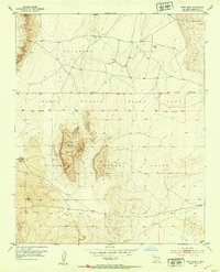
The Rio Grande corridor in the late 1930s reveals a complex network of irrigation and drainage infrastructure essential to the valley's settlement. Numerous ditches and canals, such as the Albuquerque Lateral, Corrales Main Canal, and Barelas Ditch, weave through large land grants including the Town of Atrisco Grant and Elena Gallegos Grant. This intricate water management system supported a string of established communities like Ranchos de Albuquerque, Los Griegos, and Arenal that flourished along the river's fertile banks before the city's mid-century expansion.
Find a feature on this map
75 named features on this map. Tap any name to fly to it.
Don’t see what you’re looking for? This feature index may not catch every label — zoom into the map to look around manually.
Map Details
Editions of this 1938 Albuquerque Map
This is the sole edition of this map. No revisions or reprints were ever made.
Other maps of this area

1888 · Bernalillo
USGS Topo · 1:125,000

1889 · Albuquerque
USGS Topo · 1:125,000

1892 · San Pedro
USGS Topo · 1:125,000

1893 · Albuquerque
USGS Topo · 1:125,000

1917 · Estancia
USGS Topo · 1:125,000

1934 · Alameda
USGS Topo · 1:24,000

1934 · West Albuquerque
USGS Topo · 1:24,000

1934 · Griegos
USGS Topo · 1:24,000

1934 · East Albuquerque
USGS Topo · 1:24,000
1952 · Wind Mesa
USGS Topo · 1:24,000