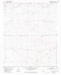
1952 Map of Los Lunas SE
USGS Topo · Published 1977About this map
Large land grant boundaries define the topography of this Valencia County landscape, where the Isleta Indian Reservation meets the historic Lo de Padilla Grant. The terrain is characterized by complex drainage systems and irrigation infrastructure, including several segments of a Ditch network that supported local agriculture during the mid-20th century. Topographic surveys from 1952 reveal natural water sources like Maes Spring and Carrizo Spring positioned against the rising elevations of the Tome Grant to the south.
Find a feature on this map
10 named features on this map. Tap any name to fly to it.
Don’t see what you’re looking for? This feature index may not catch every label — zoom into the map to look around manually.
Map Details
Editions of this 1952 Los Lunas SE Map
2 editions found
Other maps of this area

1917 · Estancia
USGS Topo · 1:125,000

1952 · Tome NE
USGS Topo · 1:24,000

1952 · Hubbell Spring
USGS Topo · 1:24,000

1952 · Tome
USGS Topo · 1:24,000

1952 · Los Lunas SE
USGS Topo · 1:24,000

1952 · Los Lunas
USGS Topo · 1:24,000

1952 · Isleta
USGS Topo · 1:24,000

1954 · Bosque Peak
USGS Topo · 1:24,000

1954 · Capilla Peak
USGS Topo · 1:24,000

1954 · Mount Washington
USGS Topo · 1:24,000