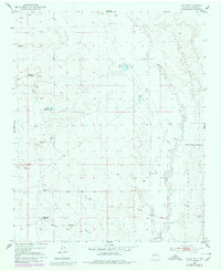
1952 Map of Belen NW
USGS Topo · Published 1980About this map
Rio Puerco defines the eastern edge of this landscape, its winding channel cutting through the semi-arid terrain of Valencia County. The map details a sophisticated network of water management essential for livestock and local agriculture in the mid-20th century. Scattered across the high ground are vital water sources such as the Pueblo Windmill, Popalito Windmill, and the Shearing Corral Windmill, alongside numerous reservoirs like Guzman Reservoir and Gabaladon Reservoir.
Find a feature on this map
19 named features on this map. Tap any name to fly to it.
Don’t see what you’re looking for? This feature index may not catch every label — zoom into the map to look around manually.
Map Details
Editions of this 1952 Belen NW Map
Other maps of this area

1917 · Cerro Verde
USGS Topo · 1:125,000

1952 · Dalies
USGS Topo · 1:24,000

1952 · Belen SW
USGS Topo · 1:24,000

1952 · Belen
USGS Topo · 1:24,000

1952 · Veguita
USGS Topo · 1:24,000

1952 · Belen NW
USGS Topo · 1:24,000

1952 · Rio Puerco
USGS Topo · 1:24,000

1954 · South Garcia SE
USGS Topo · 1:24,000

1954 · Socorro
USGS Topo · 1:250,000

1956 · South Garcia
USGS Topo · 1:62,500