1980s Maps of Valencia County, New Mexico
Explore 7 historic maps of Valencia County from the 1980s. These maps offer a rare glimpse into what life looked like during the 1980s — showing old roads, neighborhoods, homes, and landmarks that have changed or disappeared over time.
Whether you're researching your family's past, planning a metal detecting trip, or studying how Valencia County's landscape evolved across the 1980s, these high-resolution maps are a powerful tool for exploring the history of this region.
- Focus on a specific era: All maps on this page are from the 1980s, giving you a focused view of this time period.
- See what’s changed: Compare century-old streets, trails, and buildings to today's modern landscape using overlays and satellite layers.
- Research with precision: Use these maps for genealogy, historical research, land use analysis, or educational projects.
- View, download, or print: Maps are fully viewable online in high resolution, and can be downloaded or printed for your own records.
Start exploring Valencia County's history through authentic maps from the 1980s. This is your window into the past.
Valencia County, NM maps
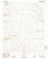
(7)- 1985 Map of Mesa Sarca
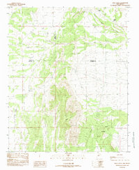 1985 Mesa Sarca1985 Print · USGSThe high-desert terrain of central New Mexico is documented in the mid-1980s as the borders of three counties converge. Researchers can trace the seasonal water network through Arroyo Pato, Coyote Draw, and the prominent rise of Mesa Sarca.
 - 1985 Map of Mesas Mojinas
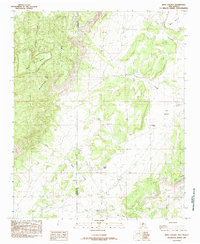
 1985 Mesas Mojinas1985 Print · USGSValencia County ranchlands are documented here in the mid-1980s, showing a landscape defined by seasonal arroyos and family-named landmarks. Researchers can trace the water-management network of the era through sites like Gurule Tank, Arroyo Salado, and Mesa Carrizo.
 - 1985 Map of White Ridge
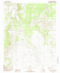
 1985 White Ridge1985 Print · USGSValencia County's high mesa country comes into focus in the 1980s, detailing the boundaries of the Laguna Indian Reservation. Trace the high-desert landscape through vital water sources like Lower Water Spring and landmarks such as Mesa Lucero.
 - 1985 Map of Mesa Gallina
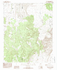
 1985 Mesa Gallina1985 Print · USGSValencia County at the height of the 1980s reveals a high-desert landscape shaped by rugged mesas and essential water tanks. Genealogists and historians can locate remote outposts like Kings Rest and trace water routes through Arroyo Lucero and the Salt Flats.
 - 1985 Map of Comanche Ranch
 1985 Comanche Ranch1985 Print · USGSSocorro County ranching life in the mid-eighties is preserved here, centered on the remote Comanche Ranch. Researchers can trace the vital network of desert water infrastructure, from Coyote Spring to numerous stock tanks like Andrew Tank and Tacho Tank.
 - 1985 Map of Correo
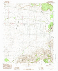 1985 Correo1985 Print · USGSValencia County and the Laguna Indian Reservation are captured here in the mid-1980s as the rail and highway corridor shaped the high-desert landscape. Researchers can locate the tracks of the Atchison Topeka and Santa Fe RR and trace the paths of Rio San Jose and Arroyo Colorado past the settlement at Correo.
 - 1986 Map of Manzano Peak
 1986 Manzano Peak1986 Print · USGSThe high peaks of the Manzano Mountains come alive in the mid-1980s, revealing a landscape of remote canyons and vital water sources. Researchers can trace the Pack Trail past Manzano Peak or locate named sites like Ojo Barreras and Wild Cow Spring.
End of results
Showing maps 1-7 of 7
Top cities of Valencia County
- Los Lunas historical maps
- Belen historical maps
- Rio Communities historical maps
- Bosque Farms historical maps
- Peralta historical maps
Frequently asked questions
- What are the different types of historical maps available for Valencia County?
- What is the oldest map of Valencia County?
- Where can I purchase historical maps of Valencia County for my home or office?
- Where can I download high-res historical maps of Valencia County?
- Are there historical topographic maps available for Valencia County?
- Is there historical aerial imagery available for Valencia County?
- Where are historical maps of Valencia County sourced from?