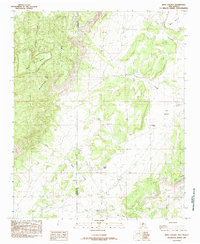
1985 Map of Mesa Gallina
USGS Topo · Published 1985About this map
Sierra Lucero dominates the high-desert landscape of this mid-1980s New Mexico survey, marking a stark geological transition across the Cibola Co Valencia Co boundary. The area is defined by a series of prominent plateaus, including Mesa Gallina and Carrizo Mesa, which overlook a network of seasonal watercourses such as Arroyo Lucero and Arroyo Salado. This topography reveals the essential role of water management in an arid environment, where isolated landmarks like North Tank, Red Tanks, and Casey Tank serve as critical points of human and livestock infrastructure. Settlement is sparse, with Kings Rest representing a singular named location amidst the broader natural features of Los Valles and Mesa Aparejo. To the south, the terrain levels into the Salt Flats, illustrating the diverse geological character of this western New Mexico territory as it was documented in the final decades of the twentieth century.
Find a feature on this map
15 named features on this map. Tap any name to fly to it.
Don’t see what you’re looking for? This feature index may not catch every label — zoom into the map to look around manually.
Map Details
Editions of this 1985 Mesa Gallina Map
This is the sole edition of this map. No revisions or reprints were ever made.
Other maps of this area

1917 · Cerro Verde
USGS Topo · 1:125,000

1954 · South Garcia SE
USGS Topo · 1:24,000

1954 · Socorro
USGS Topo · 1:250,000

1956 · South Garcia
USGS Topo · 1:62,500

1956 · Mesa Aparejo
USGS Topo · 1:62,500

1958 · Socorro
USGS Topo · 1:250,000

1960 · Cerro Verde
USGS Topo · 1:24,000

1962 · Socorro
USGS Topo · 1:250,000
1964 · Chicken Mountain
USGS Topo · 1:24,000
1964 · Puerto De Los Cavadores
USGS Topo · 1:24,000