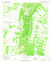
1964 Map of Puerto De Los Cavadores
USGS Topo · Published 1967About this map
Sierra Lucero dominates this mid-century landscape, a prominent ridge running north-to-south through a remote section of the New Mexico interior. The map records the high-elevation transition between Valencia and Socorro Counties, where the rugged topography is defined by significant passes such as Puerto de Bartolo Pino and the namesake Puerto de los Cavadores.
Find a feature on this map
16 named features on this map. Tap any name to fly to it.
Don’t see what you’re looking for? This feature index may not catch every label — zoom into the map to look around manually.
Map Details
Editions of this 1964 Puerto De Los Cavadores Map
This is the sole edition of this map. No revisions or reprints were ever made.
Other maps of this area

1917 · Cerro Verde
USGS Topo · 1:125,000

1954 · Socorro
USGS Topo · 1:250,000

1956 · Mesa Aparejo
USGS Topo · 1:62,500

1958 · Socorro
USGS Topo · 1:250,000

1959 · Riley
USGS Topo · 1:62,500

1962 · Socorro
USGS Topo · 1:250,000

1964 · La Jara Peak
USGS Topo · 1:24,000

1964 · Field Ranch
USGS Topo · 1:24,000
1964 · Cerro Del Oro
USGS Topo · 1:24,000
1964 · Chicken Mountain
USGS Topo · 1:24,000