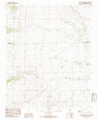
1985 Map of Comanche Ranch
USGS Topo · Published 1985About this map
Comanche Ranch sits at the heart of this high-desert landscape in central New Mexico, where the terrain is defined by a sophisticated network of water management and ephemeral drainages. The map reveals a ranching economy reliant on scattered water sources such as Diego Tank, Bryce Tank, and Llequa Tank, which punctuate the arid surroundings. The drainage patterns are clearly marked by the Arroyo Monte Largo and Arroyo Comanche, showing how seasonal runoff moves through the land toward larger features like the Coyote Draw.
Find a feature on this map
15 named features on this map. Tap any name to fly to it.
Don’t see what you’re looking for? This feature index may not catch every label — zoom into the map to look around manually.
Map Details
Editions of this 1985 Comanche Ranch Map
This is the sole edition of this map. No revisions or reprints were ever made.
Other maps of this area

1916 · La Joya
USGS Topo · 1:125,000

1917 · Cerro Verde
USGS Topo · 1:125,000

1952 · La Joya NW
USGS Topo · 1:24,000

1952 · Belen SW
USGS Topo · 1:24,000

1952 · Belen NW
USGS Topo · 1:24,000

1954 · Socorro
USGS Topo · 1:250,000

1956 · Mesa Aparejo
USGS Topo · 1:62,500

1958 · Socorro
USGS Topo · 1:250,000

1959 · Riley
USGS Topo · 1:62,500

1962 · Socorro
USGS Topo · 1:250,000