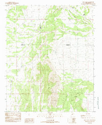
1985 Map of Mesa Sarca
USGS Topo · Published 1985About this map
Mesa Sarca dominates this high-desert landscape in central New Mexico, where the borderlands of Cibola, Valencia, and Socorro Counties meet. Compiled from late-1970s aerial photography, the survey reveals a dryland geography defined by intricate drainage systems and water catchment features essential for ranching and survival in the arid Southwest. Notable watercourses including Arroyo Pato, Arroyo Monte, and Arroyo Largo cut through the terrain, leading toward the Coyote Draw in the southeast. This 1985 provisional map reflects a period of modern land management, documenting local water sources such as Ojo Saladito, Rock Tank, and Middle Tank. The grid of county lines provides a clear framework for researchers tracing property boundaries or historical land use across these three adjoining New Mexico counties.
Find a feature on this map
11 named features on this map. Tap any name to fly to it.
Don’t see what you’re looking for? This feature index may not catch every label — zoom into the map to look around manually.
Map Details
Editions of this 1985 Mesa Sarca Map
This is the sole edition of this map. No revisions or reprints were ever made.
Other maps of this area

1917 · Cerro Verde
USGS Topo · 1:125,000

1954 · Socorro
USGS Topo · 1:250,000

1956 · Mesa Aparejo
USGS Topo · 1:62,500

1958 · Socorro
USGS Topo · 1:250,000

1959 · Riley
USGS Topo · 1:62,500

1962 · Socorro
USGS Topo · 1:250,000

1964 · La Jara Peak
USGS Topo · 1:24,000
1964 · Chicken Mountain
USGS Topo · 1:24,000
1964 · Puerto De Los Cavadores
USGS Topo · 1:24,000
1978 · Acoma Pueblo
USGS Topo · 1:100,000