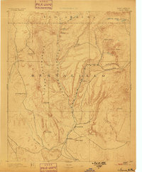
1890 Map of Jemes
USGS Topo · Published 1898About this map
Jemes Pueblo and San Ysidro anchor the southern valleys of this 1880s New Mexico landscape, where the confluence of Jemes Creek and Rio Salado shapes the local settlement pattern. The map reveals a transition from high-elevation thermal features like Sulphur Springs to the deep incisions of Canyon San Diego and Canyon Guadalupe. Evidence of early territorial industry appears at the San Miguel Mine on the western slopes of the Sierra Nacimiento, highlighting the intersection of geological exploration and resource extraction during this era.
Find a feature on this map
31 named features on this map. Tap any name to fly to it.
Don’t see what you’re looking for? This feature index may not catch every label — zoom into the map to look around manually.
Map Details
Editions of this 1890 Jemes Map
2 editions found
Other maps of this area

1883 · Mt. Taylor
USGS Topo · 1:250,000

1886 · Mt. Taylor
USGS Topo · 1:250,000

1888 · Bernalillo
USGS Topo · 1:125,000

1889 · Albuquerque
USGS Topo · 1:125,000

1889 · Largo
USGS Topo · 1:250,000

1890 · Jemes
USGS Topo · 1:125,000

1892 · San Pedro
USGS Topo · 1:125,000

1892 · Jemes
USGS Topo · 1:125,000

1892 · Santa Clara
USGS Topo · 1:125,000

1892 · Mt. Taylor
USGS Topo · 1:250,000