Old Maps of Lea County, New Mexico
Explore 492 old maps of Lea County, spanning from 1942 to today. These high-resolution historic maps reveal how streets, neighborhoods, landmarks, and natural features evolved over time — perfect for genealogy, metal detecting, research, and local history exploration.
What you can do with these maps:
- See how Lea County changed over time: Compare historical maps to modern-day views to trace roads, homesites, rail lines & more.
- View detailed metadata: Each map includes creators, publishers, year, scale, and archive source.
- Overlay maps with satellite & LiDAR: Visualize the past alongside modern tools to explore terrain & human change.
- Trusted historical sources: Maps sourced from the USGS, Library of Congress, and other archives.
- Access maps your way: View online, download high-res files, or order prints for personal or research use.
Start exploring old maps of Lea County to uncover forgotten places, hidden landmarks, and the deep history beneath your feet.
Lea County, NM maps
(492)- 1942 Map of Clayton Basin, 1958 Print
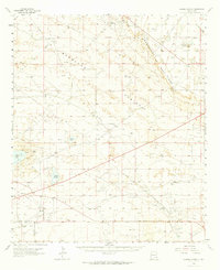
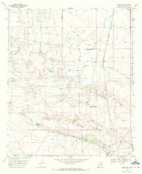
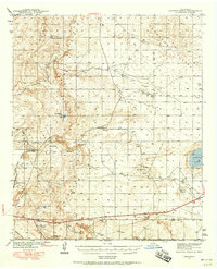 1942 Clayton Basin1958 Print · USGSSoutheastern New Mexico's potash and ranching country comes to life in the years surrounding World War II. Researchers can locate family outposts like Lusk Ranch and Wood Ranch or trace the early industrial footprint of the Potash Co of America Mine.2 unique versions available
 - 1943 Map of Clayton Basin
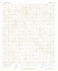
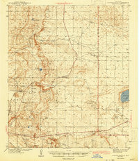 1943 Clayton Basin1943 Print · USGSEddy and Lea Counties are mapped here during the early 1940s as the potash industry and ranching shaped the high desert landscape. Genealogists and historians can locate old cattle headquarters like Lusk Ranch and trace the spur of the Santa Fe Railroad (Oil City).2 unique versions available
 - 1954 Map of Hobbs, 1963 Print
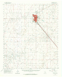
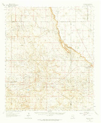
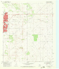
 1954 Hobbs1963 Print · USGSThe High Plains and Permian Basin transition is captured here at the height of the mid-century energy boom. Genealogists and industrial historians can trace the foundations of Humble City, locate the Potash Mine and Plant, and follow the Texas-New Mexico RR.2 unique versions available
 - 1954 Map of Brownfield, 1975 Print
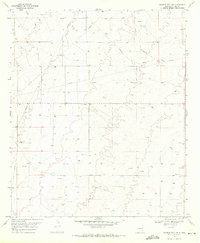
 1954 Brownfield1975 Print · USGSThe High Plains of the Texas-New Mexico border are captured here in the mid-twentieth century, as ranching and oil extraction shaped the Llano Estacado. Genealogists and historians can trace small rural centers like Lums Chapel, Hillburn City, and the Friendship Sch amid a landscape of windmills.2 unique versions available
 - 1958 Map of Brownfield
 1958 Brownfield1958 Print · USGSThe High Plains of the Texas-New Mexico border are captured here during a mid-century oil boom. Genealogists and historians can trace old community sites like Lums Chapel and Tokio alongside the vast Levelland and Slaughter Oil and Gas Field.
 - 1958 Map of Hobbs
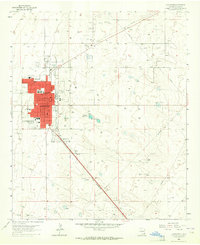
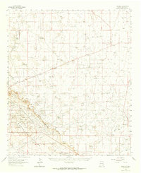
 1958 Hobbs1958 Print · USGSThe High Plains of the Texas-New Mexico border are shown here during the height of the mid-century oil boom. Genealogists and historians can trace the development of Hobbs, Lovington, and Jal, alongside ranching landmarks like James Ranch and the early Texas-New Mexico Railway.
 - 1961 Map of Johnson Ranch, 1989 Print
 1961 Johnson Ranch1989 Print · USGSIn the high desert of Sandoval County during the early sixties, this area centered on the Johnson Trading Post amidst a landscape of mesas and arroyos. Researchers can locate remote water sources like Max Lopez Spring and trace mid-century infrastructure like the local Landing Strip.
 - 1962 Map of Brownfield
 1962 Brownfield1962 Print · USGSThe High Plains of Texas and New Mexico are captured in the early sixties as a thriving hub of oil production and ranching. Researchers can trace the industrial footprint of the Levelland and Slaughter Oil and Gas Field or locate smaller towns like Sundown and Littlefield.
 - 1962 Map of Lovington, 1964 Print
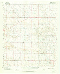
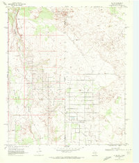
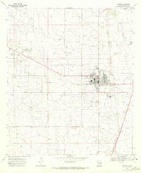
 1962 Lovington1964 Print · USGSLovington was a thriving Lea County center in the early sixties, defined by its expanding schools and oil industry. Genealogists and historians can locate specific sites like Lea Sch, the County Fairground, and the expansive Dean Oil Field.2 unique versions available
 - 1962 Map of Lovington, 1964 Print
 1962 Lovington1964 Print · USGSLovington and the surrounding Lea County plains appear at a peak of mid-century industrial development and ranching life. Researchers can trace family history at the Lovington Cem or locate historic ranch boundaries like Eidson Ranch and Kimbrough Ranch.
 - 1962 Map of Buckeye, 1965 Print
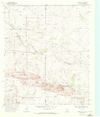
 1962 Buckeye1965 Print · USGSLea County ranching and petroleum production are in full swing in the early sixties as the oil fields expand across the high plains. Genealogists and historians can locate family landmarks like the York Ranch and Martin Ranch or trace the early footprint of the Vacuum Oil Field.
 - 1963 Map of Oil Center, 1964 Print
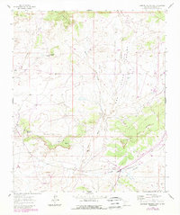
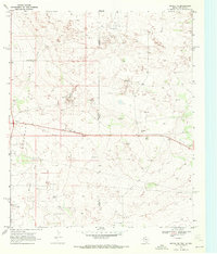
 1963 Oil Center1964 Print · USGSLea County in the early sixties was a landscape defined by the growing petroleum industry and the essential search for water. Researchers can trace the mid-century infrastructure of the Monument Jal Oil Field and locate isolated landmarks like San Simon Ranch and San Simon Sink.2 unique versions available
 - 1963 Map of Monument, 1964 Print
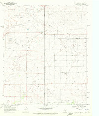
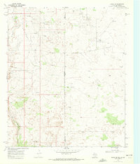
 1963 Monument1964 Print · USGSThe high plains of Lea County in the early sixties reveal a landscape shaped by the mid-century oil boom and traditional ranching. Researchers can trace family history at Crockett Cem or locate the infrastructure of the Pearl Oil Field and the Texas-New Mexico RR.
 - 1963 Map of Laguna Gatuna, 1965 Print
 1963 Laguna Gatuna1965 Print · USGSThe high plains of Lea County are defined by industrial growth and desert ranching in the early sixties. Researchers can trace family ranch lands like Smith Ranch and Alfred Ranch alongside the sprawling Corbin Oil Field and the Hobbs Air Force Base Auxiliary Field No 4.2 unique versions available
 - 1963 Map of Hat Mesa, 1965 Print
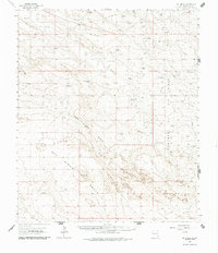
 1963 Hat Mesa1965 Print · USGSThe high plains of the New Mexico borderlands are captured in the early sixties as the ranching and oil economies began to overlap. Researchers can locate remote outposts like Brinninstool Ranch and trace vital water sources from Dagger Lake to Rogers Well.2 unique versions available
 - 1963 Map of Maljamar, 1965 Print
 1963 Maljamar1965 Print · USGSSoutheast New Mexico’s oil and ranching landscape is captured here in the early sixties, centered on the dramatic rise of The Caprock. Genealogists and historians can trace the footprint of early energy workers at Booker Camp and rural life at Bond Ranch or Youngs.2 unique versions available
 - 1969 Map of Humble City, 1971 Print
 1969 Humble City1971 Print · USGSLea County at the end of the sixties shows a landscape transformed by the energy industry and modern infrastructure. Genealogists and historians can trace the network of pipelines, several Gravel Pits, and landmarks like Wardswell Draw.4 unique versions available
 - 1969 Map of Hobbs SW, 1971 Print
 1969 Hobbs SW1971 Print · USGSSoutheast New Mexico’s oil-driven economy is on full display in the late sixties as the energy industry transformed the Lea County landscape. Genealogists and historians can trace the Texas - New Mexico railroad through Warren, locate the Monument Cem, and see the industrial footprint of the Carbon Plant.2 unique versions available
 - 1969 Map of Hobbs East, 1972 Print
 1969 Hobbs East1972 Print · USGSThe Texas-New Mexico border near Hobbs thrived during the late sixties as the energy sector shaped the landscape. Genealogists and local historians can trace civic growth through Highland Jr High Sch, find family sites at Prairie Haven Cem, and locate the historic East Hobbs Oil Field.3 unique versions available
 - 1969 Map of Jal NE, 1972 Print
 1969 Jal NE1972 Print · USGSThe energy-rich borderlands of West Texas and New Mexico come into focus during a period of intense petroleum development. Trace the infrastructure of the Jal Oil Field along the stateline, including a Gas Plant and Monument Draw.3 unique versions available
 - 1969 Map of Humble City NE, 1972 Print
 1969 Humble City NE1972 Print · USGSThe Texas-New Mexico borderlands in the late sixties reveal a landscape of expanding energy production and cattle ranching. Researchers can trace the development of the Texpac Oil Field or locate the site of the Airport (Abandoned) and Waits Ranch.4 unique versions available
 - 1969 Map of Eunice, 1972 Print
 1969 Eunice1972 Print · USGSSoutheast New Mexico's oil-driven economy is on full display in the late sixties as the town of Eunice expands alongside the Monument Jal Oil Field. Researchers can trace local development through the Lea County-Eunice Airport, the local Cem, and the Drive-in Theater.2 unique versions available
 - 1969 Map of Hobbs SE, 1972 Print
 1969 Hobbs SE1972 Print · USGSThe high plains of the Texas-New Mexico border come into focus in the late 1960s as ranching and oil exploration intersect. Trace the industrial footprint across Monument Draw through its networks of pipelines and sites like Kornegay Ranch.2 unique versions available
 - 1969 Map of Eunice NE, 1972 Print
 1969 Eunice NE1972 Print · USGSThe Texas-New Mexico borderlands in the late sixties come alive with the infrastructure of the Permian Basin's petroleum industry. Researchers can trace the development of the Elliott Oil Field, locate the small settlement of Jones City, and find water sources like Baker Spring.2 unique versions available
 - 1969 Map of Eunice SE, 1972 Print
 1969 Eunice SE1972 Print · USGSThe Texas and New Mexico borderlands come alive in the late sixties as a high-production oil landscape. Researchers can trace the intensive development of the Drinkard Oil Field and Nelson Oil Field or locate the remote Giles Ranch.3 unique versions available
Showing maps 1-25 of 492
Top cities of Lea County
- Hobbs historical maps
- Lovington historical maps
- Eunice historical maps
- Jal historical maps
- Tatum historical maps
Frequently asked questions
- What are the different types of historical maps available for Lea County?
- What is the oldest map of Lea County?
- Where can I purchase historical maps of Lea County for my home or office?
- Where can I download high-res historical maps of Lea County?
- Are there historical topographic maps available for Lea County?
- Is there historical aerial imagery available for Lea County?
- Where are historical maps of Lea County sourced from?