Old Maps of Los Alamos, New Mexico
Explore 39 old maps of Los Alamos, spanning from 1892 to today. These high-resolution historic maps reveal how streets, neighborhoods, landmarks, and natural features evolved over time — perfect for genealogy, metal detecting, research, and local history exploration.
What you can do with these maps:
- See how Los Alamos changed over time: Compare historical maps to modern-day views to trace roads, homesites, rail lines & more.
- View detailed metadata: Each map includes creators, publishers, year, scale, and archive source.
- Overlay maps with satellite & LiDAR: Visualize the past alongside modern tools to explore terrain & human change.
- Trusted historical sources: Maps sourced from the USGS, Library of Congress, and other archives.
- Access maps your way: View online, download high-res files, or order prints for personal or research use.
Start exploring old maps of Los Alamos to uncover forgotten places, hidden landmarks, and the deep history beneath your feet.
Los Alamos, NM maps
(39)- 1892 Map of Santa Clara
 1892 Santa Clara1892 Print · USGSUpper New Mexico at the end of the nineteenth century reveals a landscape shaped by the Rio Grande and the arrival of the rails. Genealogists and historians can trace traditional settlements like San Ildefonso and Peña Blanca alongside the burgeoning Santa Fé Southern Railway.4 unique versions available
 - 1952 Map of White Rock, 1954 Print
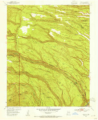
 1952 White Rock1954 Print · USGSThe high mesas of Los Alamos and Santa Fe counties are captured here in the early fifties, documenting the remote canyon systems and early utility networks. Genealogists and historians can trace land grant boundaries and find markers of early industry like the Old Railroad Grade and Totavi.3 unique versions available
 - 1952 Map of Frijoles, 1954 Print
 1952 Frijoles1954 Print · USGSThe Pajarito Plateau's high mesas and deep canyons are shown in the early fifties, a time when these archaeological landscapes were under federal stewardship. Trace the ancient paths of the Stone Lions Trail to reach the Pueblo of the Stone Lions and the Ceremonial Cave.3 unique versions available
 - 1952 Map of Puye, 1954 Print
 1952 Puye1954 Print · USGSThe Pajarito Plateau in the early fifties reveals a landscape of deep canyons and ancient heritage. Researchers can locate archaeological sites like the Cliff Dwellings at Puye or trace the early industrial footprint of the General Pumice Mine.4 unique versions available
 - 1952 Map of Guaje Mountain, 1954 Print
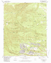
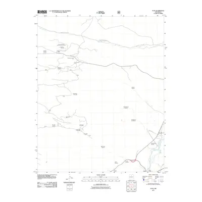
 1952 Guaje Mountain1954 Print · USGSLos Alamos and the surrounding high desert mesas are captured here in the early fifties, documenting a landscape of deep canyons and tribal lands. Researchers can trace the Quemazon Trail, locate ancient Pueblo Ruins, and study the boundaries of the Santa Clara Pueblo Grant.3 unique versions available
 - 1953 Map of Frijoles, 1958 Print
 1953 Frijoles1958 Print · USGSThe Pajarito Plateau was a landscape of deep canyons and volcanic mesas in the years following the war. Genealogists and historians can trace the mining remnants at Bland, ancestral Pueblo Ruins, and early homesteads like the Evans Griffin Place.3 unique versions available
 - 1953 Map of Espanola, 1958 Print
 1953 Espanola1958 Print · USGSNorthern New Mexico in the early fifties shows a landscape of deep canyons and ancestral Pueblo lands along the RIO GRANDE. Genealogists and historians can trace family-named sites like Evans Ranch or locate ancient Cliff Dwellings and the Old Railroad Grade.3 unique versions available
 - 1958 Map of Albuquerque
 1958 Albuquerque1958 Print · USGSAlbuquerque and the surrounding high desert are captured here during a period of massive federal expansion and postwar growth. Researchers can trace the development of Kirtland Air Force Base, find ancestral homes in Pueblo de Santa Ana, or locate industrial sites like the Jackpile Mine.
 - 1962 Map of Albuquerque
 1962 Albuquerque1962 Print · USGSAlbuquerque and the surrounding high desert are captured here in the early 1960s during a period of intense mineral and military growth. Genealogists and historians can locate early schools like the Pueblo Pintado School, major industrial sites like the Jackpile Mine, and the sprawling Kirtland Air Force Base.
 - 1963 Map of Albuquerque, 1965 Print
 1963 Albuquerque1965 Print · USGSMid-century New Mexico unfolds across this map, showcasing the intersection of ancient pueblos, modern military bases, and historic mining districts. Trace family roots and local history through the Ortiz Mine, Seven Lakes Trading Post, and Alameda.3 unique versions available
 - 1978 Map of Los Alamos
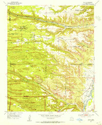
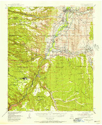
 1978 Los Alamos1978 Print · USGSThe Jemez Mountains and Rio Grande valley come together in the late seventies, showing a land defined by volcanic peaks and ancient pueblos. Trace the footprints of Bandelier National Monument, find the rail line of the Atchison Topeka and Santa Fe, and locate historic settlements like Jemez Pueblo.
 - 1983 Map of Albuquerque, 1984 Print
 1983 Albuquerque1984 Print · USGSCentral New Mexico in the early eighties shows a landscape where ancient pueblos and modern aerospace hubs meet. Trace the routes of the Atchison Topeka and Santa Fe RR or locate landmarks like Kirtland Air Force Base, Madrid, and the Sandia Mountains.
 - 1984 Map of White Rock
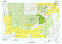
 1984 White Rock1984 Print · USGSLos Alamos County was undergoing significant residential growth in the mid-eighties as modern neighborhoods expanded atop the mesas. Local historians can trace ancestral sites like Tsankawi Ruins and Tshirege Ruins or follow the Old Railroad Grade along the Rio Grande.2 unique versions available
 - 1984 Map of Frijoles
 1984 Frijoles1984 Print · USGSThe Pajarito Plateau during the mid-eighties shows a landscape defined by archaeological heritage and federal research facilities. Researchers can trace ancestral sites like Tyuonyi Ruin and Stone Lions Shrine alongside the growth of Los Alamos.3 unique versions available
 - 1984 Map of Guaje Mountain
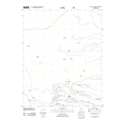
 1984 Guaje Mountain1984 Print · USGSLos Alamos and the surrounding canyonlands appear in the mid-eighties as a complex mix of government research, tribal lands, and mesa-top neighborhoods. Genealogists and historians can trace local development through the Guaje Pines Cem, Barranca Mesa Sch, and the Univ of N Mex (Los Alamos) campus.3 unique versions available
 - 2002 Map of Guaje Mountain, 2003 Print
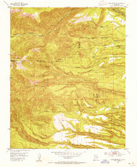
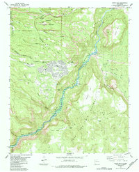
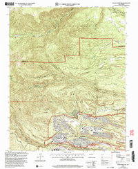 2002 Guaje Mountain2003 Print · USGSLos Alamos and its surrounding mesas are documented here at the turn of the millennium, showing the unique intersection of a world-class laboratory and the New Mexico landscape. Researchers can trace the layout of North Mesa, find the Guaje Pines Cemetery, and locate the Los Alamos National Laboratory.
 - 2002 Map of White Rock, 2003 Print
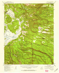
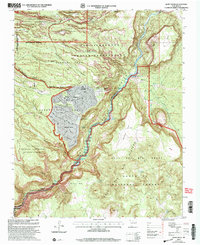 2002 White Rock2003 Print · USGSNorthern New Mexico at the start of the millennium reveals a fascinating intersection of laboratory science, tribal lands, and suburban expansion. Trace the boundaries of the Los Alamos National Laboratory as it neighbors White Rock and the San Ildefonso Indian Reservation.
 - 2002 Map of Puye, 2003 Print
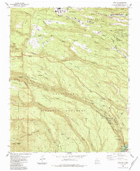
 2002 Puye2003 Print · USGSNew Mexico's high plateaus and ancestral lands are shown in great detail during the early 2000s as the modern lab facilities expanded. Researchers can trace the proximity of Los Alamos National Laboratory to sacred sites like the Puya Cliff Dwellings and the San Ildefonso Pueblo Grant.
 - 2002 Map of Frijoles, 2003 Print
 2002 Frijoles2003 Print · USGSModern scientific infrastructure meets ancient landscapes in the mesas around Los Alamos during the early 2000s. Trace the boundaries of the Los Alamos National Laboratory and the historic Ramon Vigil Grant, or locate the Ceremonial Cave within Bandelier National Monument.
 - 2011 Map of White Rock, 2011 Print
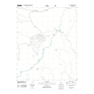 2011 White Rock2011 Print · USGSCovers Los Alamos, including White Rock, Buckman, and other nearby areas
 - 2011 Map of Puye, 2011 Print
 2011 Puye2011 Print · USGSCovers Los Alamos, including Otowi, Pajarito Village, and other nearby areas
 - 2011 Map of Frijoles, 2011 Print
 2011 Frijoles2011 Print · USGSCovers Los Alamos, including Frijoles, Upper Frijoles Crossing, and other nearby areas
 - 2011 Map of Guaje Mountain, 2011 Print
 2011 Guaje Mountain2011 Print · USGSCovers Los Alamos, including Sandoval County, Los Alamos County, and other nearby areas
 - 2013 Map of Puye, 2013 Print
 2013 Puye2013 Print · USGSCovers Los Alamos, including Otowi, Pajarito Village, and other nearby areas
 - 2013 Map of Guaje Mountain, 2013 Print
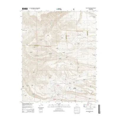 2013 Guaje Mountain2013 Print · USGSCovers Los Alamos, including Sandoval County, Los Alamos County, and other nearby areas
Showing maps 1-25 of 39
Top cities near Los Alamos
Frequently asked questions
- What are the different types of historical maps available for Los Alamos?
- What is the oldest map of Los Alamos?
- Where can I purchase historical maps of Los Alamos for my home or office?
- Where can I download high-res historical maps of Los Alamos?
- Are there historical topographic maps available for Los Alamos?
- Is there historical aerial imagery available for Los Alamos?
- Where are historical maps of Los Alamos sourced from?