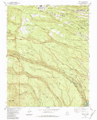
1984 Map of Frijoles
USGS Topo · Published 1984About this map
Bandelier National Monument and the Santa Fe National Forest dominate this landscape, revealing a complex network of canyons and mesas etched into the Pajarito Plateau. This mid-1980s record documents significant archaeological and cultural sites, including the Tyuonyi Ruin, Frijolito Ruins, and the remote Yapashi Ruins. The presence of the Stone Lions Shrine and Ceremonial Cave illustrates the deep human history of the Rito de los Frijoles valley.
Find a feature on this map
57 named features on this map. Tap any name to fly to it.
Don’t see what you’re looking for? This feature index may not catch every label — zoom into the map to look around manually.
Map Details
Editions of this 1984 Frijoles Map
Other maps of this area

1892 · Santa Clara
USGS Topo · 1:125,000

1952 · White Rock
USGS Topo · 1:24,000

1952 · Valle Toledo
USGS Topo · 1:24,000

1952 · Frijoles
USGS Topo · 1:24,000

1952 · Puye
USGS Topo · 1:24,000

1952 · Montoso Peak
USGS Topo · 1:24,000

1952 · Guaje Mountain
USGS Topo · 1:24,000

1953 · Cochiti Dam
USGS Topo · 1:24,000

1953 · Bland
USGS Topo · 1:24,000

1953 · Canada
USGS Topo · 1:24,000