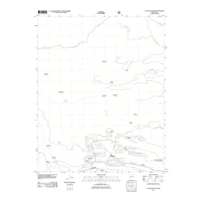
2011 Map of Guaje Mountain
USGS Topo · Published 2011About this map
Los Alamos sits atop a series of prominent finger mesas, defining the developed southern portion of this high-altitude landscape in the Jemez Mountains. The 2011 survey details the complex geography of Barranca Mesa, North Mesa, and South Mesa, where residential streets and institutional facilities like the University of New Mexico Los Alamos Branch terminate at steep canyon drops. To the north, the terrain transitions into a wilderness of deep drainage systems including Vallecitos Canyon and Agua Piedra Canyon, largely traversed by service routes like Indian Service Route 602. This map documents the critical infrastructure supporting this isolated mountain community, from the Los Alamos Airport and Los Alamos Post Office to water resources such as Guaje Reservoir and Los Alamos Reservoir. The transition from the dense laboratory-adjacent townsite to the rugged slopes of Guaje Mountain and Caballo Mountain highlights the unique spatial constraints of this historic scientific outpost.
Find a feature on this map
37 named features on this map. Tap any name to fly to it.
Don’t see what you’re looking for? This feature index may not catch every label — zoom into the map to look around manually.
Map Details
Editions of this 2011 Guaje Mountain Map
This is the sole edition of this map. No revisions or reprints were ever made.
Other maps of this area

1892 · Santa Clara
USGS Topo · 1:125,000

1918 · Abiquiu
USGS Topo · 1:125,000

1952 · White Rock
USGS Topo · 1:24,000

1952 · Valle Toledo
USGS Topo · 1:24,000

1952 · Frijoles
USGS Topo · 1:24,000

1952 · Puye
USGS Topo · 1:24,000

1952 · Guaje Mountain
USGS Topo · 1:24,000

1953 · Chili
USGS Topo · 1:24,000

1953 · Vallecitos
USGS Topo · 1:24,000

1953 · Polvadera Peak
USGS Topo · 1:24,000