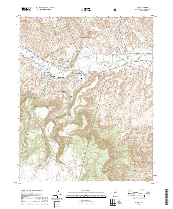
1918 Map of Abiquiu
USGS Topo · Published 1918About this map
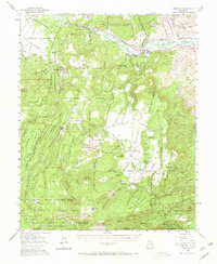
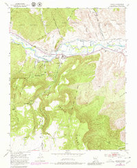
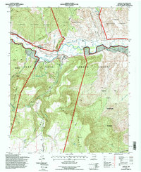
The Chama River serves as the central artery through this Rio Arriba landscape, where early 20th-century life is organized around Spanish land grants and traditional settlements. Based on topography from the Carson Forest and reconnaissance by N. H. Darton, the map documents the complex geography of the San Juan Pueblo Grant and the Piedra Lumbre Grant. Significant peaks like Cerro Pedernal and Abiquiu Peak overlook valley communities such as Abiquiu and El Rito. The northeastern corridor is defined by the Rio Caliente River and the settlement of Ojo Caliente, while a branch of the D. and R. G. R. R. follows the Rio Grande south toward Española. The presence of numerous land grants, including the Ojo Caliente Grant and Black Mesa Grant, illustrates the enduring structure of property and governance in this high-altitude region.
Find a feature on this map
37 named features on this map. Tap any name to fly to it.
Don’t see what you’re looking for? This feature index may not catch every label — zoom into the map to look around manually.
Map Details
Editions of this 1918 Abiquiu Map
This is the sole edition of this map. No revisions or reprints were ever made.
Historical Maps of Espanola Through Time
9 maps found