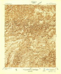
1937 Map of Jemez Springs
USGS Topo · Published 1937About this map
Jemez Springs and the surrounding canyons of the Santa Fe National Forest are documented here just before World War II. The landscape is a network of land grants and ranching operations, including the Baca Location No 1 and San Diego Grant. Settlement patterns follow the water, with dozens of small ranching outposts like Martinez Ranch and Thompson Ranch established near reliable water sources like San Antonio Creek.
Find a feature on this map
75 named features on this map. Tap any name to fly to it.
Don’t see what you’re looking for? This feature index may not catch every label — zoom into the map to look around manually.
Map Details
Editions of this 1937 Jemez Springs Map
This is the sole edition of this map. No revisions or reprints were ever made.
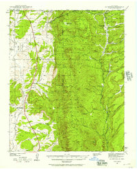
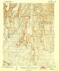
Other maps of this area

1890 · Jemes
USGS Topo · 1:125,000

1892 · Jemes
USGS Topo · 1:125,000

1892 · Santa Clara
USGS Topo · 1:125,000

1909 · Gallina
USGS Topo · 1:125,000

1918 · Abiquiu
USGS Topo · 1:125,000
1939 · La Ventana
USGS Topo · 1:62,500

1939 · San Ysidro
USGS Topo · 1:62,500

1940 · Cuba
USGS Topo · 1:62,500

1943 · San Ysidro
USGS Topo · 1:62,500
1943 · Jemez
USGS Topo · 1:62,500